Kinport Peak
| Site Name: | Kinport Peak | 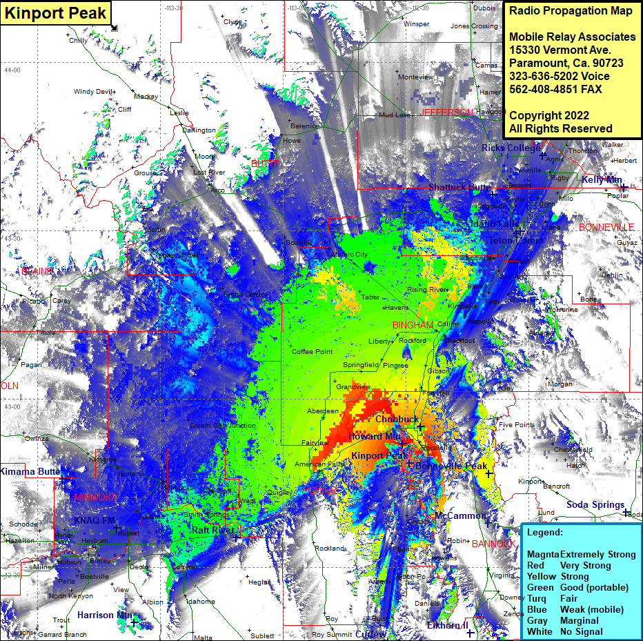 Kinport Peak Coverage |
| Latitude: | 042 48 30.2N | 42.8083889 |
| Longitude: | 112 29 12.5W | -112.4868056 |
| Feet | Meters | |
| Ground Elevation: | 7228.0 | 2,203.1 |
| HAAT: | 2,038.1 | 621.2 |
| City: | Pocatello | |
| County: | Bannock | |
| State: | Idaho |
This is not an MRA Owned Site. For space rental contact the site owner.
Do you own or manage this site? Click Here
Would you like to add a site to the Google Earth Map?? Click Here
Site Coverage: Coverage of Bannock, American Falls, Fairview, Quigley, Wapi, DeWolf, Smith Springs, Acequia, Rupert, Minidoka, Norland, Kimama, Cream Can Junctions, Cotterel, Deola, Idahome, North Kenyon, Beetville, Burley, Hobson, Heyburn, Budge, Rupert, Norland, MInidoka, Coffee Point, Aberdeen, Fingal, Grandview, Springfield, Pingree, Liberty, Rockford, Havens, Taber, Atomic City, Cerro Grande, Scoville, Smith Corrals, Tepee Circles, Martin, Era, Lost River, Arco, Howe, Berenice, Mud Lake, Monteview, Blue Dome, Hawgood, Lewisville, Bassett, Payne, Osgood, Rigby, Milo, Ucon, Orvin, Iona, Cotton, Shelley, Woodville, Basalt, Rising River, Goshen Junction, Firth, Goshen, McDonaldville, Blackfoot, Gibson, Fort Hall, Gay, Five Points, Pocatello, Hawgood, Hamer, Camas, Edmonds, Herman, Saint Anthony, Parker, Sugar City, Teton, Twin Grove, Shodde, Eden, Hazelton, Milney, Owihza, Pagari, Tikura