Menan Butte
| Site Name: | Menan Butte | 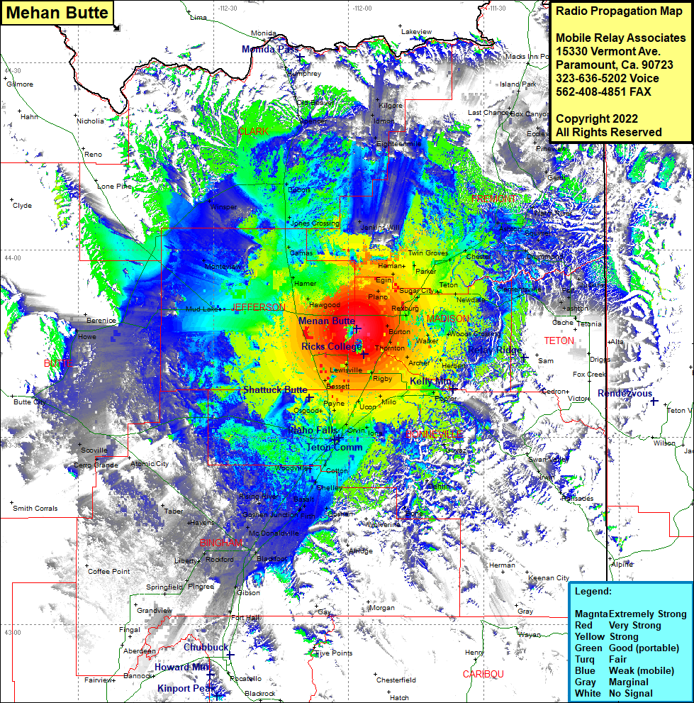 Menan Butte Coverage |
| Latitude: | 043 47 21.9N | 43.7894167 |
| Longitude: | 111 58 08.0W | -111.9688889 |
| Feet | Meters | |
| Ground Elevation: | 5603.0 | 1,707.8 |
| HAAT: | 831.8 | 253.5 |
| City: | Thornton | |
| County: | Madison | |
| State: | Idaho |
This is not an MRA Owned Site. For space rental contact the site owner.
Do you own or manage this site? Click Here
Would you like to add a site to the Google Earth Map?? Click Here
Site Coverage: Coverage of Jenkins Will, Eighteenmile, Idmon, Kilgore, Hinkley, Edmonds, Sugar City, Rexburg, Teton, Parker, Herman, Twin Groves, Chester, Ashton, Squirrel, Drummond, Warm River, Gerrit, Pineview, Eccles, Box Canyon, Last Chance, Lackson Landing, Trude, Island Park, Judkins, Felt, Ashton, Tetonia, Woods Crossing, Walker, Thronton, Burton, Rigby, Lewisville, Bassett, Payne, Osgood, Orvin, Iona, Ucon Milo, Poplar, Irwin, Palisades, Guyaz, Dehlin, Bone, Cotton, Shelley, Woodville, Basalt, Rising River, Goshen Junction, Firth, Wolverine, McDonaldville, Blackfoot, Gibson, Fort Hall, Havens, Taber, Rockford, Liberty, Pingree, Springfield, Atomic City, Cerro Grande, Scoville, Howe, Berenice, Mud Lake, Monteview, Hawgood, Harmer, Camas, Jones Crossing, Dubois, Winsper, Spencer, Old Beaver, Humphrey