Monida Pass
| Site Name: | Monida Pass | 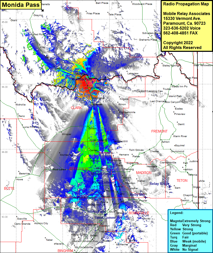 Monida Pass Coverage |
| Latitude: | 044 30 58.4N | 44.5162222 |
| Longitude: | 112 10 49.0W | -112.1802778 |
| Feet | Meters | |
| Ground Elevation: | 7945.0 | 2,421.6 |
| HAAT: | 888.3 | 270.7 |
| City: | Humphrey | |
| County: | Clark | |
| State: | Idaho |
This is not an MRA Owned Site. For space rental contact the site owner.
Do you own or manage this site? Click Here
Would you like to add a site to the Google Earth Map?? Click Here
Site Coverage: Coverage of Monida, Lima, Dell, Kidd, Humphrey, Old Beaver, Spencer, Kilgore, Idmon, Eighteenmile, Debois, Winsper, Jones Crossing, Camas, Monteview, Mud Lake, Hamer, Hawgood, Edmonds, Plano, Butron, Thornton, Rigby, Archer, Milo, Ucon, Bassett, Payne, Osgood, Orvin, Iona, Idaho Falls, Woodville, Cotton, Shelley, Basalt, Firth, Goshen Junction, Rising River