Mountain Home
| Site Name: | Mountain Home | 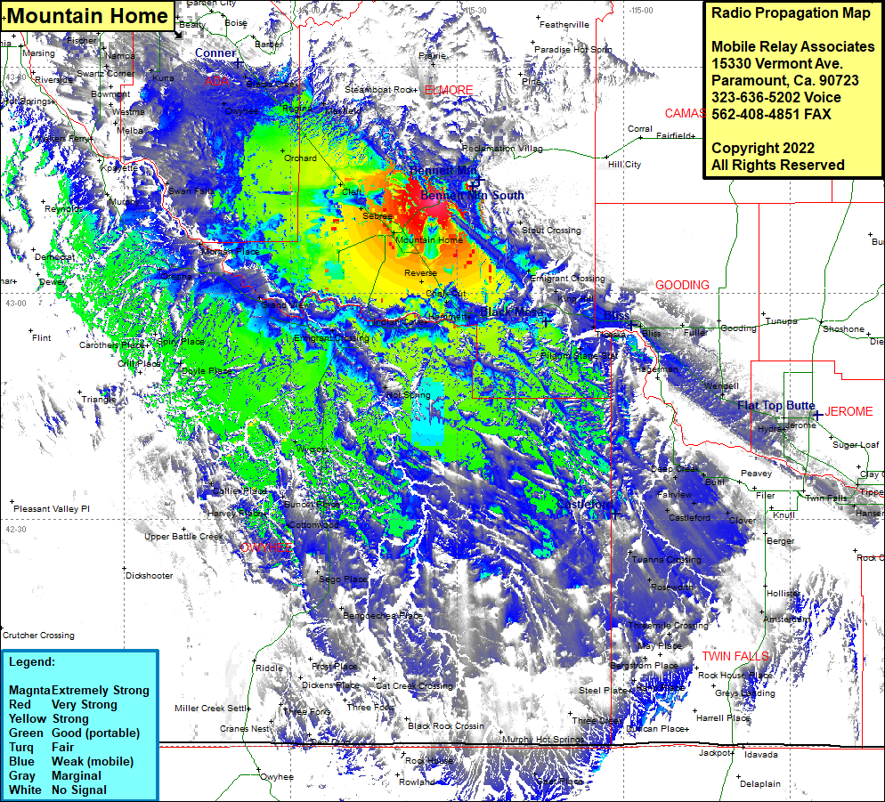 Mountain Home Coverage |
| Latitude: | 043 12 18.8N | 43.2052222 |
| Longitude: | 115 33 54.5W | -115.5651389 |
| Feet | Meters | |
| Ground Elevation: | 4405.0 | 1,342.6 |
| HAAT: | 306.1 | 93.3 |
| City: | Mountain Home | |
| County: | Elmore | |
| State: | Idaho |
This is not an MRA Owned Site. For space rental contact the site owner.
Do you own or manage this site? Click Here
Would you like to add a site to the Google Earth Map?? Click Here
Site Coverage: Coverage of Mountain Home, Stout Crossing, Emigrant Crossing, King Hill, Ticeska, Bliss, Tuttle, Pilgrim Stage Station, Deep Creek, Fairview, Castleford, Clover, Buhl, Clover, Tuanna Crossing, Roseworth, Threemile Crossing, Indian Jim Place, Anderson Place, Steel Place, Dickens Place, Three Forks, Bengoechea Place, Sego Place, Harvey Place, Buncel Place, Wycross, Collier Place, Dry Forty, Hot Springs, Bruneau, Emigrant Crossing, Indian Cover, Hammett, Chalk Cut, Reverse, Grans View, Oreans, Morgan Place, Swan Falls, Murphy, Watters Ferry, Melba, Westma, Bowmont, Mora, Kuna, Owyhee, Leone, Blacks Creek, Barber, Orchard, Cleft, Sebree, Eaght, Sonna, Star, Middleton