Nampa
| Site Name: | Nampa | 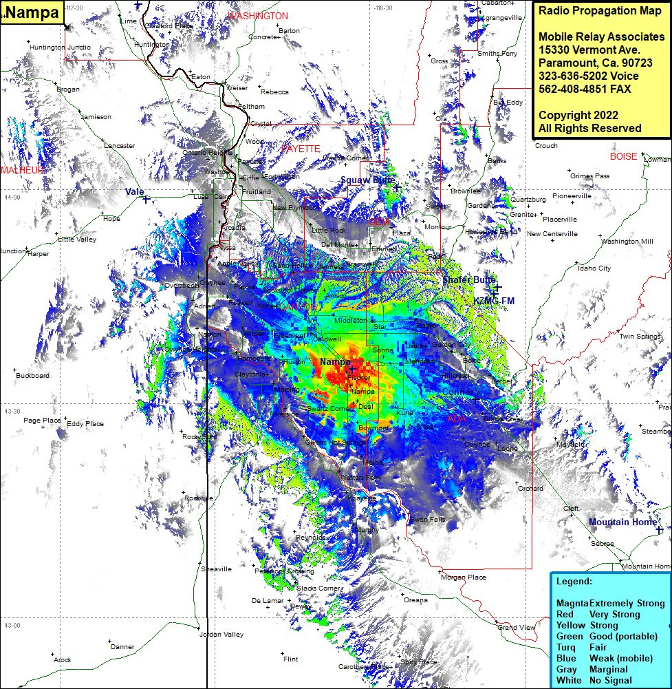 Nampa Coverage |
| Latitude: | 043 34 45.7N | 43.5793611 |
| Longitude: | 116 33 25.7W | -116.5571389 |
| Feet | Meters | |
| Ground Elevation: | 2491.0 | 759.3 |
| HAAT: | -10.8 | -3.3 |
| City: | Nampa | |
| County: | Canyon | |
| State: | Idaho |
This is not an MRA Owned Site. For space rental contact the site owner.
Do you own or manage this site? Click Here
Would you like to add a site to the Google Earth Map?? Click Here
Site Coverage: Coverage of Fischer, Nampa, Deal, Kings Corner, Kuna, Mora, Bowmont, Westma, Melba, Walters Ferry, Kpayette, Murphy, Swan Falls, Givens Hot Springs, Riverside, Marsing, Claytonia, Midway, Underfofters Corner, Central Cove, Homedale, Owyhee Heights, Caldwell, Greenleaf, Wilder, Napton, Enrose, Notus, Rookstool Corner, Roswell, Parma, Adrian, Overstreet, Owyhee, Apple Valley, Nyssa, Arcadia, Cairo, Buckingham, Fruitland, Gayway Corner, Washoe, Fayette, Ontario Heights, Ingard, Fort Wilson, New Plymoouth, Little Rock, Letha, Del Monte, Jenness, Bramwell, Emmett, Black Canyon, Montour, Middleton, Maddens, Star, Eagle, Cloverdale, Sonna, Meridian, Ustick, Garden City, Highlands, Boise, Vernon, Hillcrest, Barber, Pearl, Perkins, Pleasant Valley, Leone, Blacks Creek