Raft River
| Site Name: | Raft River | 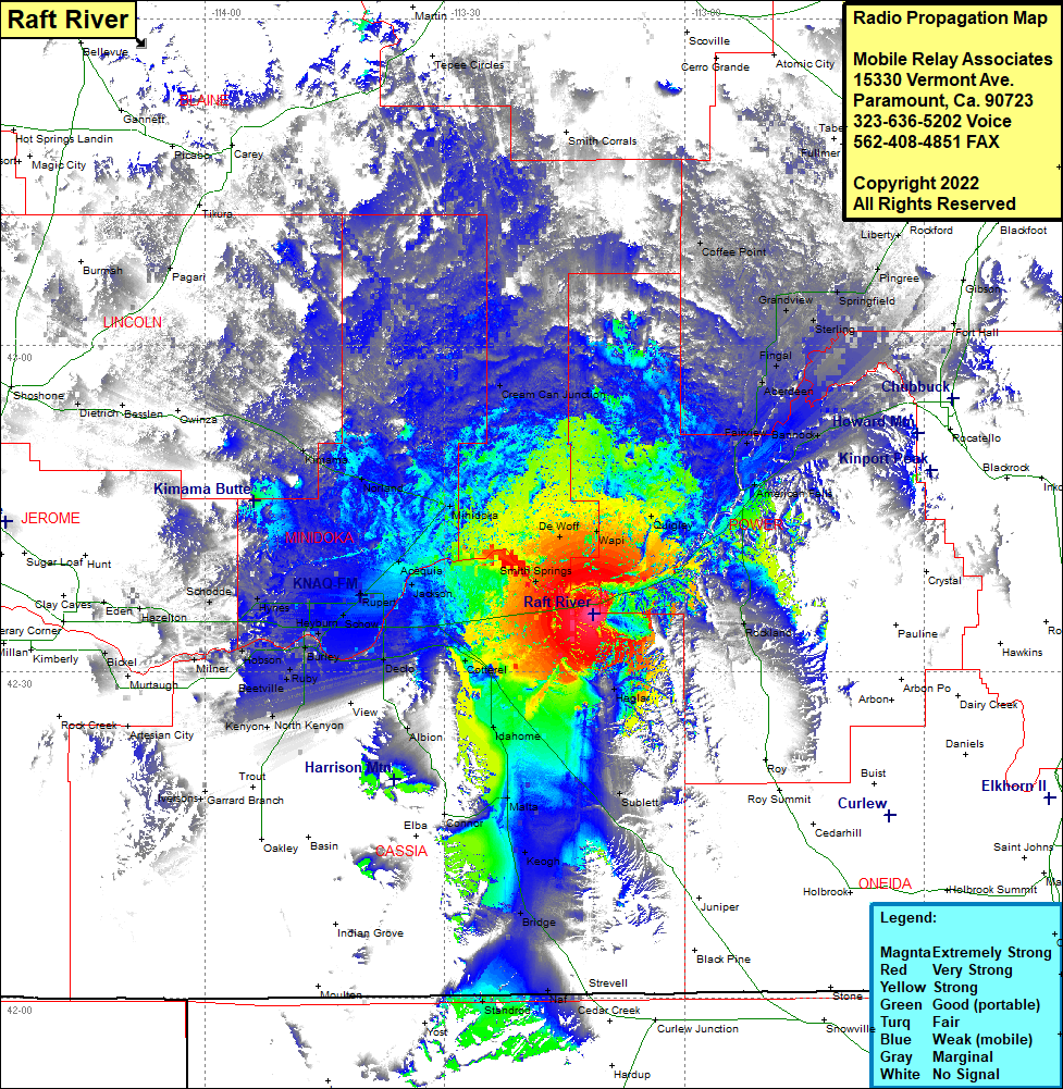 Raft River Coverage |
| Latitude: | 042 35 15.8N | 42.5877222 |
| Longitude: | 113 11 20.8W | -113.1891111 |
| Feet | Meters | |
| Ground Elevation: | 4604.0 | 1,403.3 |
| HAAT: | 181.8 | 55.4 |
| City: | Yale | |
| County: | Cassia | |
| State: | Idaho |
This is not an MRA Owned Site. For space rental contact the site owner.
Do you own or manage this site? Click Here
Would you like to add a site to the Google Earth Map?? Click Here
Site Coverage: Coverage of Rockland, Heglar, Sublette, Keogh, Bridge, Malta, Naf, Strevell, Standrod, Idahome, Cotteral, Albion, Declo, View, Kenyon, North Kenyon, Beetville, Pella, Burlay, Heyburn, Rupert, Acequia, Hobson, Milner, Bickely, Hazelton, Eden, Schodde, Hynes, MInidoka, Norland, Kimama, Dietrich, Pagan, Tikura, Cream Can Junction, DeWolf, Wapi, Quigley, American Falls, Fairview, Aberdeen, Bannock, Fingal, Gransview, Sterling, Springfield, Pingree, Coffee Point, Springfield, Pingree, Liberty, Fort Hall, Bannock