Shafer Butte
| Site Name: | Shafer Butte | 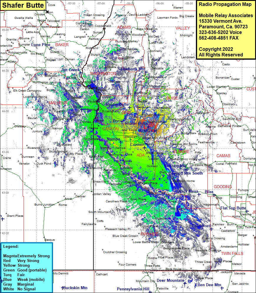 Shafer Butte Coverage |
| Latitude: | 043 46 17.7N | 43.7715833 |
| Longitude: | 116 05 19.6W | -116.0887778 |
| Feet | Meters | |
| Ground Elevation: | 7596.0 | 2,315.3 |
| HAAT: | 2985.3 | 909.9 |
| City: | Idaho City | |
| County: | Boise | |
| State: | Idaho |
This is not an MRA Owned Site. For space rental contact the site owner.
Do you own or manage this site? Click Here
Would you like to add a site to the Google Earth Map?? Click Here
Site Coverage: Coverage of Banks, Placerville, Pioneerville, Centerville, Horseshoe Bend, Gardena, Biose, Barber, Blacks Creek, Steamboat Rocks, Mayfield, Regina, Orchard, Cleft, Sebree, Mountain Home, Reverse, Chalk Cut, Pilgrim Stage Station, Indian Cove Bruneau, Hot Spring, Emigrant Crossing, Grand View, Morgan Place, Oreana, Spiry Place, Doyle Place, Crill Place, Murphy, Kpayette, Swan Falls, Reynolds, Dewey, DeLama, Petersons Crossing, Walters Ferry, Givens Hot Springs, Westma, Melba, Kuna, Nampa, Marsing, Claytonia, Holedale, Wilder, Napton, Owyhee Heights, Adrian, Parma, Nyssa, Luse, Hamilton Corner, Fruitland, Lethe, Emmett, Montour, Sweet, Gardena, Hamilton Corner, Fruitland, Wood, Crystal, Feltham, Payette, Fort Wilson, Buckingham, Palidades Corner, Hamilton Corner, New Plymouth, Eiffie, Ingard, Gayway Corner, Washoe, Ontario Heights, Cairo, Rebecca, Weiser, Jonathan, Eaton, Crawford Place, Dennis, Lancaster, Jamieson, Brogan, Midvale, Cambridge, Indian Village, French Corner