Shattuck Butte
| Site Name: | Shattuck Butte | 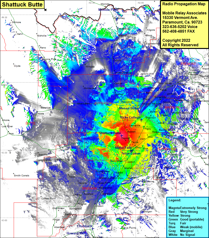 Shattuck Butte Coverage |
| Latitude: | 043 36 22.0N | 43.6061111 |
| Longitude: | 112 08 44.1W | -112.1455833 |
| Feet | Meters | |
| Ground Elevation: | 5173.0 | 1,576.7 |
| HAAT: | 403.9 | 123.1 |
| City: | Idaho Falls | |
| County: | Bonneville | |
| State: | Idaho |
This is not an MRA Owned Site. For space rental contact the site owner.
Do you own or manage this site? Click Here
Would you like to add a site to the Google Earth Map?? Click Here
Site Coverage: Coverage of Bassett, Roberts, Hawgood, Hamer, Camas, Jones Crossing, Dubois, Spencer, Old Beaver, Kilgore, Idmon, Eighteenmile, Jenkins Will, Edmonds, Plano, Lewisville, Annis, Thornton, Burton, Rexburg, Hibbard, Salem, Egin, Parker, Herman, Twin Groves, Saint Anthony, Chester, Eighteenmile, Idmon, Kilgore, Hibbard, Egin, Herman, Parker, Twin Groves, Saint Anthony, Chester, Ashton, Warm River, Lamont, Drummond, Grainville, Clementsville, Newdale, Sugar City, Wilford, Rexburg, Walker, Woods Crossing Herbert, Archer, Poplar, Ririe, Milo, Ucon, Rigby, Iona, Orvin, Payne, Osgood, Coltman, Grant, Guyaz, Dehlin, Bone, Wolverine, Goshen Alridge, Idaho Falls, Woodville, Cotton, Mitchell, Shelley, Gerard, Goshen, Basalt, Firth, Rising River, Kimball, McDonaldville, Groveland, Blackfoot, Gibson, Fort Hall, Rockford, Liberty, Pingree, Springfield, Grandview, Olden, Taber, Atomic City, Cerro Grande, Scoville, Coffee Point, Howe, Berenice, Mud Lake, Monteview, Winsper