Teton Comm
| Site Name: | Teton Comm | 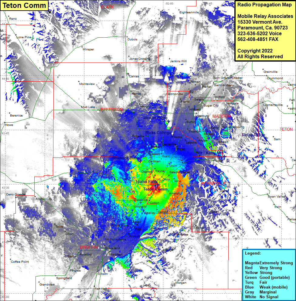 Teton Comm Coverage |
| Latitude: | 043 29 30.4N | 43.4917778 |
| Longitude: | 112 02 58.2W | -112.0495000 |
| Feet | Meters | |
| Ground Elevation: | 4716.0 | 1,437.4 |
| HAAT: | 12.3 | 3.8 |
| City: | Idaho Falls | |
| County: | Bonneville | |
| State: | Idaho |
This is not an MRA Owned Site. For space rental contact the site owner.
Do you own or manage this site? Click Here
Would you like to add a site to the Google Earth Map?? Click Here
Site Coverage: Coverage of Osgood, Bassett, Roberts, Sage Junction, Hawgood, Hamer, Camas, Jones Crossing, Mud Lake, Payne, Coltman, Grant, Barlow, Lewisville, Annis, Labelle, Rigby, Grant, Ucon, Lorenzo, Thornton, Burton, Rexburg, Hinckley, Plano, Edmonds, Egin, Salem, Sugar City, Egin, Herman, Parker, Saint Anthony, Twin Groves, Chester, WIlford, Newdale, Moody, Walker, Woods Crossing, Jensen, Archer, Herbert, Ririe, Poplas, Milo, Beachs Corner, Iona, Ammon, Guyaz, Dehlin, Bone, Wolverine, Goshen, Shelley, Cotton, Woodville, Mitchell, Basalt, Rising River, Firth, Kimball, McDonaldville, Groveland, Blackfoot, Gibson, Fort Hall, Pingree, Liverty, Rockford, Rouse, Olsen, Taber, Atomic City