Wardner Peak
| Site Name: | Wardner Peak | 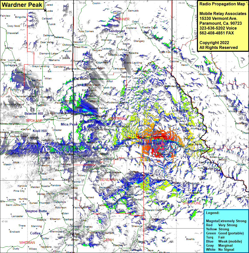 Wardner Peak Coverage |
| Latitude: | 047 29 34.2N | 47.4928333 |
| Longitude: | 116 08 36.0W | -116.1433333 |
| Feet | Meters | |
| Ground Elevation: | 6180.0 | 1,883.7 |
| HAAT: | 2,608.4 | 795.0 |
| City: | Wardner | |
| County: | Shoshone | |
| State: | Idaho |
This is not an MRA Owned Site. For space rental contact the site owner.
Do you own or manage this site? Click Here
Would you like to add a site to the Google Earth Map?? Click Here
Site Coverage: Coverage of Cataldo, Enaville, Smelterville, Linfor, Kellogg, Osburn, Masonia, Wallace, Webb, Mullan, Larson, Mace, Delta, Thiard, Saint Joe, Conkling Park, Chatcolet, Hawleys Landing, Worley, Mozart, Saxby, Coey, Freeman, Mica, Valleyford, Mount Hope, Darknell, Plaza, Benewah, Flat Creek, Rover, Mashburn, Santa, Harvard, Onaway, Grinnell, Wooley, Plummer