Colstrip
| Site Name: | Colstrip | 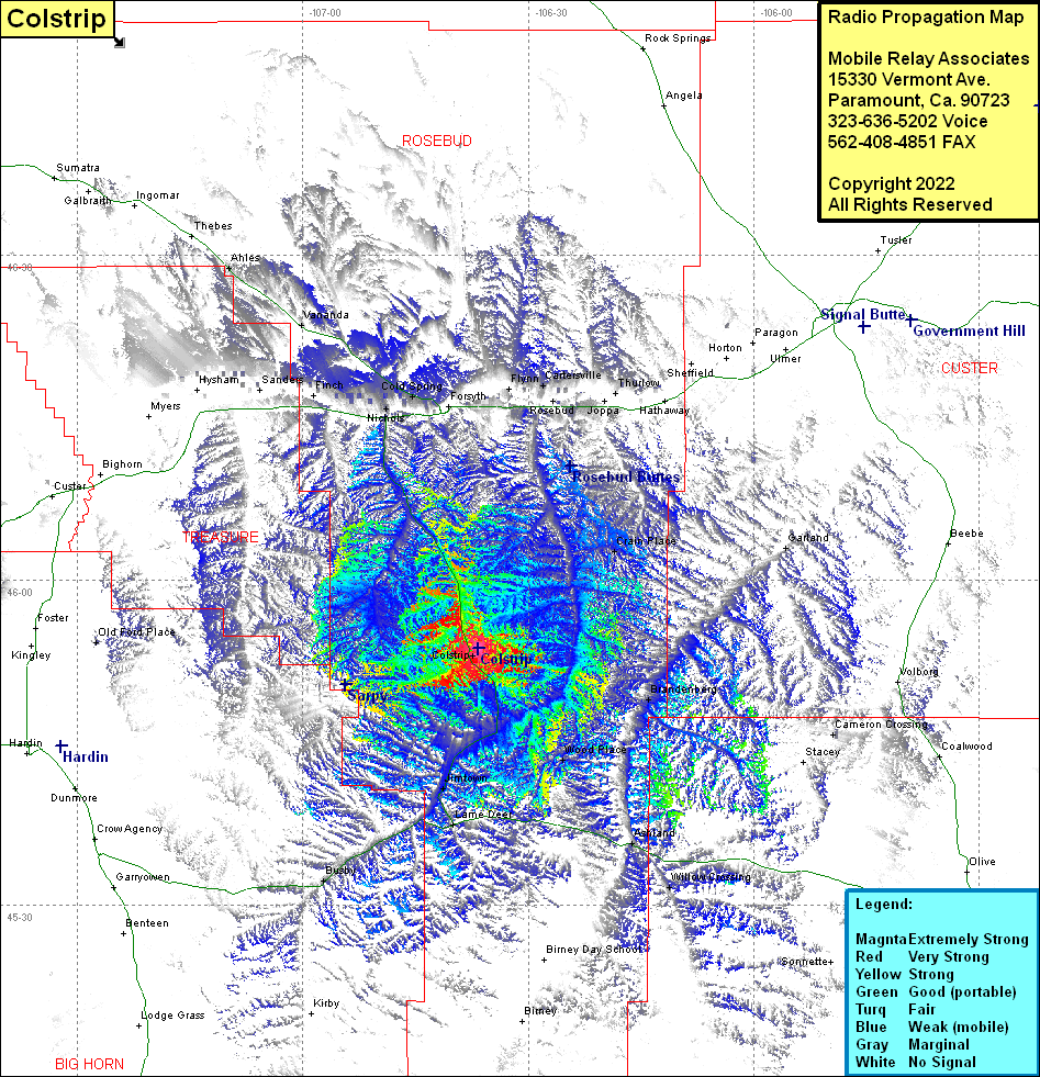 Colstrip Coverage |
| Latitude: | 045 53 42.5N | 45.8951389 |
| Longitude: | 106 36 40.6W | -106.6112778 |
| Feet | Meters | |
| Ground Elevation: | 3434.0 | 1,046.7 |
| HAAT: | 249.3 | 76.0 |
| City: | Colstrip | |
| County: | Rosebud | |
| State: | Montana |
This is not an MRA Owned Site. For space rental contact the site owner.
Do you own or manage this site? Click Here
Would you like to add a site to the Google Earth Map?? Click Here
Site Coverage: Coverage of Crain Place, Rosebud, Thurlow, Cartersville, Flynn, Garland, Cameron Crossing, Wood Place, Brandenberg, Ashland, Willow Crossing, Jimtown, Lame Deer, Busby, Nichols, Sanders, Cold Spring, Vananda, Ahles, Montana Highway 39 from Interstate 94 in the north to US Highway 212 in the south