KDXT-FM
| Site Name: | KDXT-FM |  KDXT-FM Coverage |
| Latitude: | 047 01 57.0N | 47.0325000 |
| Longitude: | 113 59 32.7W | -113.9924167 |
| Feet | Meters | |
| Ground Elevation: | 7514.0 | 2,290.3 |
| HAAT: | 2,451.2 | 747.1 |
| City: | Grass Valley | |
| County: | Missoula | |
| State: | Montana |
This is not an MRA Owned Site. For space rental contact the site owner.
Do you own or manage this site? Click Here
Would you like to add a site to the Google Earth Map?? Click Here
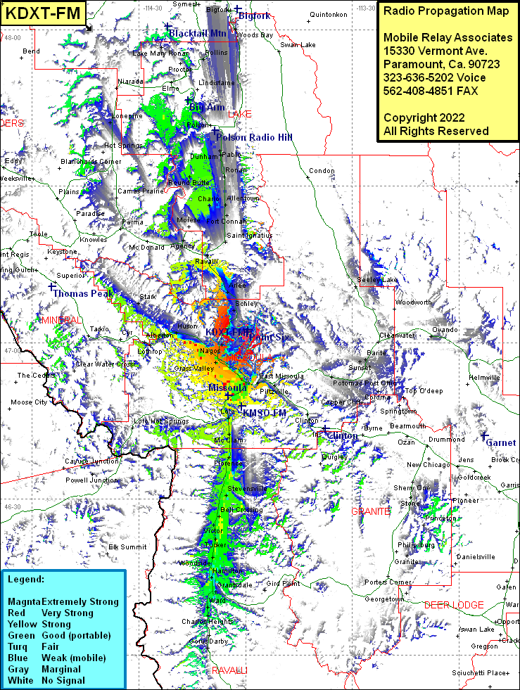
Site Coverage: Coverage of Seeley Lake, Missoula, East Missoula, Piltzville, Turah, Potomac Post Office, McNamara, West Riverside, Bonner Junction, Gird Point, Ravenna, Sunset, Barrite, Greenough, Copper Cliff, Coloma, Top O’deep, Reynolds City, Garnet, Coloma, Huson, Soudan, Alberton, Lothrop, Cyr, Tarkio, Frenchtown, Schilling, Primrose, Grass Valley, De Smet, Orchard Homes, Fort Missoula, Lolo, McClain, Carlton, Florence, Kenspur, Kenspur, Stevensville, Bell Crossing, Victor, Victor Crossing, Tucker, Cobb, Quast, Woodside, Riverside, Hamilton, Grantsdale, Ward, Charlos Heights, Coma, Gorus, Darby, University Heights, Huson, Soudan, Stark, Schley, Arlee, Ravalli, Dixon, Agency, Post Creek, Fort Connah, Allentown, Charlo, Saint Ignastius, Round Butte, Ronan, Pablo, Dunham, Polson, Rollins, Woods Bay, Lake Mary Ronan, Dayton, Perma, Lonepine
