Bayard Tower
| Site Name: | Bayard Tower | 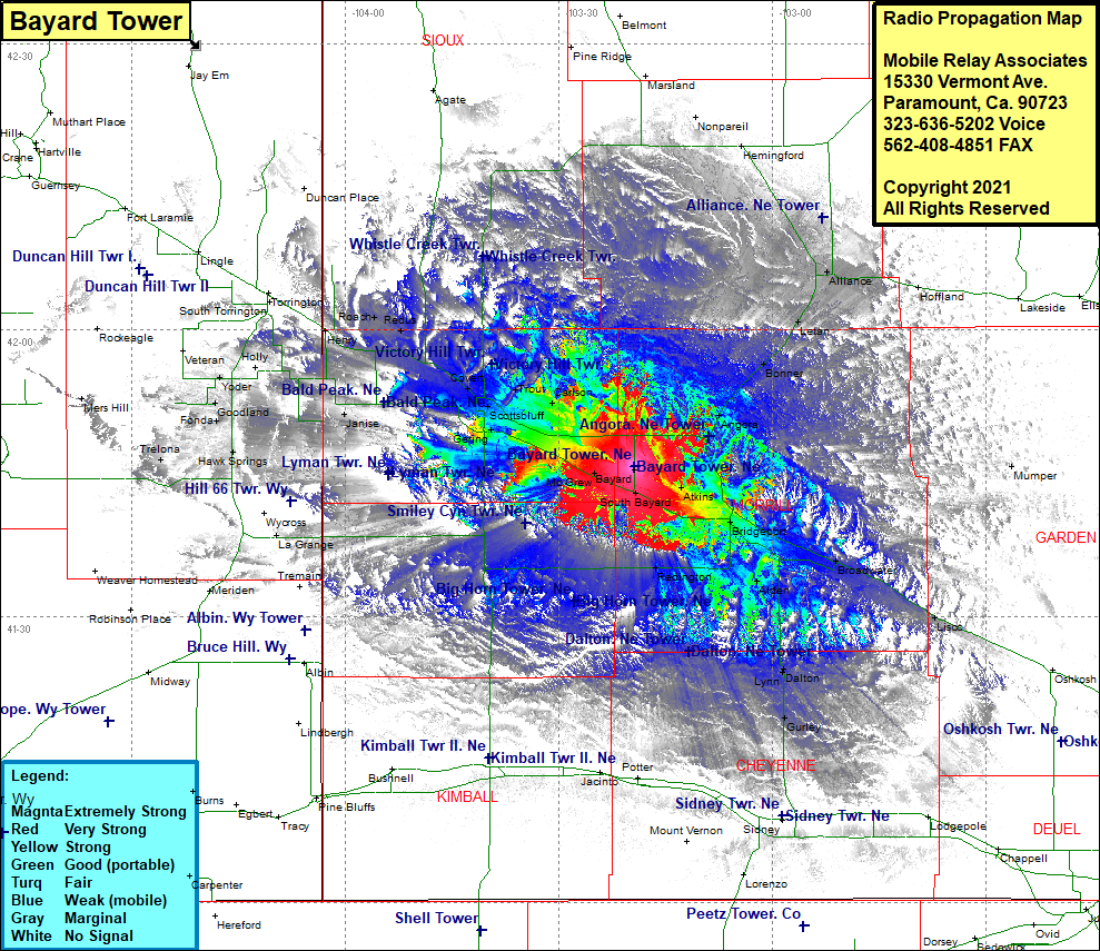 Bayard Tower Coverage |
| Latitude: | 041 45 43.9N | 41.7621944 |
| Longitude: | 103 19 20.9W | -103.3224722 |
| Feet | Meters | |
| Ground Elevation: | 3839.0 | 1170.1 |
| HAAT: | 32.7 | 10.0 |
| City: | Bayard | |
| County: | Morrill | |
| State: | Nebraska |
This is not an MRA Owned Site. For space rental contact the site owner.
Do you own or manage this site? Click Here
Would you like to add a site to the Google Earth Map?? Click Here
Site Coverage: Coverage of Alliance, Letan, Bonner, Angora, Kemp, Northport, Bridgeport, Broadwater, Alden, Lynn, Dalton, Gurley, Redington, South Bayard, Bayard, Atlins, McGrew, Minatare, Tony, Carlson, Trout, Gerling, Fonda, Goodland, Yoder, Lyman, South Morrill, Morrill, Roach, Redus