Ogallala Tower
| Site Name: | Ogallala Tower | 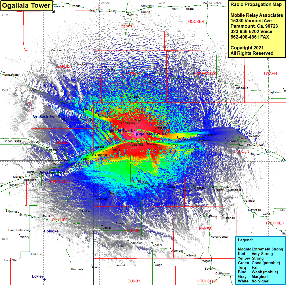 Ogallala Tower Coverage |
| Latitude: | 041 11 01.1N | 41.1836389 |
| Longitude: | 101 40 20.3W | -101.6723056 |
| Feet | Meters | |
| Ground Elevation: | 3538.0 | 1078.4 |
| HAAT: | 569.3 | 173.5 |
| City: | Ogallala | |
| County: | Keith | |
| State: | Nebraska |
This is not an MRA Owned Site. For space rental contact the site owner.
Do you own or manage this site? Click Here
Would you like to add a site to the Google Earth Map?? Click Here
Site Coverage: Coverage of Martin, Lyons Place, Rounds Place, Lyons Place, Calora, Lena, Flats, Tryon, McKeag, Broganville, Ogallala, Roscoe, Paxton, Sarben, Coker, Sutherland, O’fallons, Birdwood, North Platte, Beck, Grant, Madrid, Elsie, Grainton, Wallace, Dickens, Somerset, Wellfleet, Onorth Platte, Marengo, Imperial, Chase, Lamar, Amherst, Venango, Brandon, Paoli, Dorsey, Ovid, Fort Sedgwick, Julesburg, Barton, Big Springs, Brule, Megeath, Lemoyne, Ruthton, Belmar, Lewellen, Oshkosh, Lisco, Rackett, Velma, Rounds Place, Flats, Calora, Lena