19KM S of Alamo
| Site Name: | 19KM S of Alamo | 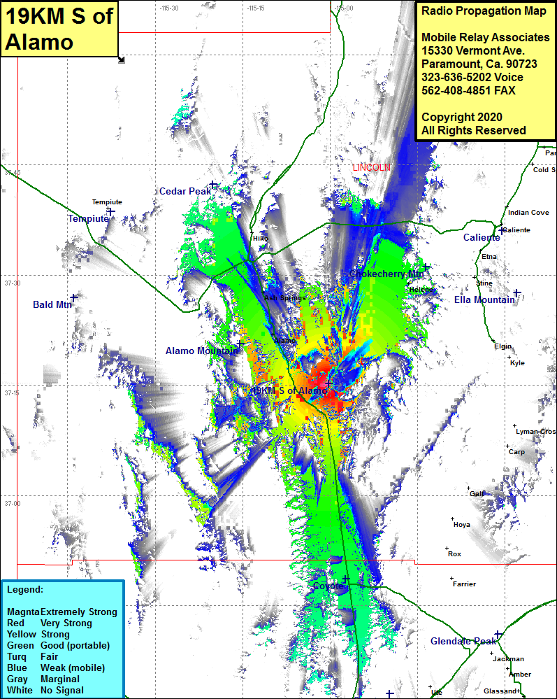 19KM S of Alamo Coverage |
| Latitude: | 037 15 9.9N | #VALUE! |
| Longitude: | 115 00 12.8W | -115.0035556 |
| Feet | Meters | |
| Ground Elevation: | 5851.0 | 1783.4 |
| HAAT: | 1683.0 | 513.0 |
| City: | Alamo | |
| County: | Lincoln | |
| State: | Nevada |
This is not an MRA Owned Site. For space rental contact the site owner.
Do you own or manage this site? Click Here
Would you like to add a site to the Google Earth Map?? Click Here
Site Coverage: Coverage of areas of Lincoln County and northern Clark county including Alamo, Ash Springs, Delamar, Abbotts Fork, US Highway 93 from the junction of Nevada 375 and Nevada 318 in the north to several miles south of the intersection with Nevada 168.