Angel Peak
| Site Name: | Angel Peak | 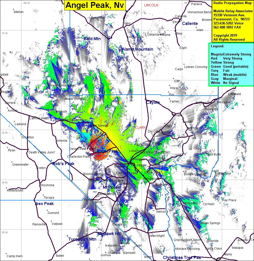 Angel Peak Coverage |
| Latitude: | 036 19 06.9N | 36.3185833 |
| Longitude: | 115 34 30.1W | -115.5750278 |
| Feet | Meters | |
| Ground Elevation: | 8861.5 | 2701.0 |
| HAAT: | 2225.2 | 678.2 |
| City: | Las Vegas | |
| County: | Clark | |
| State: | Nevada |
This is not an MRA Owned Site. For space rental contact the site owner.
Do you own or manage this site? Click Here
Would you like to add a site to the Google Earth Map?? Click Here
Site Coverage: Coverage of Hwy 95, Camp Desert Rock, Las Vegas, Lovell, Desert View Point, Mercury, Sugar Bunker, Mine Mtn Jct, Henderson