Aurora Peak
| Site Name: | Aurora Peak | 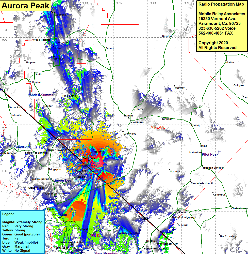 Aurora Peak Coverage |
| Latitude: | 038 16 38.5N | 38.2773611 |
| Longitude: | 118 51 38.5W | -118.8606944 |
| Feet | Meters | |
| Ground Elevation: | 8739.0 | 2663.6 |
| HAAT: | 1358.1 | 414.0 |
| City: | Fletcher | |
| County: | Mineral | |
| State: | Nevada |
This is not an MRA Owned Site. For space rental contact the site owner.
Do you own or manage this site? Click Here
Would you like to add a site to the Google Earth Map?? Click Here
Site Coverage: Coverage of the western portion of Mineral County and the southern portion of Lyon County, Mono Lake, Lee Vining, Mono Mills, Dunderberg Mill, Bodie, Cray Mill, Del Monte, Fletcher, Lower Town, Upper Town, Thorne, California Hwy 167 / Nevada Hwy 359 from US395 Mono Lake area to several miles east of the Nevada border and many portions of Nevada Hwy 3C