Austin Peak
| Site Name: | Austin Peak | 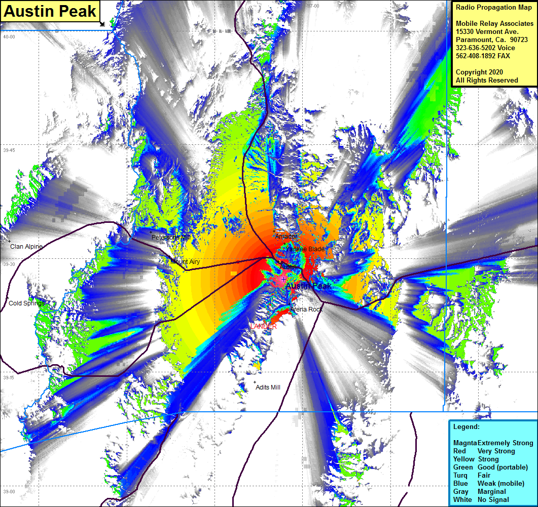 Austin Peak Coverage |
| Latitude: | 039 27 13.0N | 39.4536111 |
| Longitude: | 117 03 16.0W | -117.0544444 |
| Feet | Meters | |
| Ground Elevation: | 8468.0 | 2581.0 |
| HAAT: | 1759.5 | 536.3 |
| City: | Austin | |
| County: | Lander | |
| State: | Nevada |
This is not an MRA Owned Site. For space rental contact the site owner.
Do you own or manage this site? Click Here
Would you like to add a site to the Google Earth Map?? Click Here
Site Coverage: Coverage of the southcentral portion of Lander County, Austin, Amador, Mt Airy, Petersons Mill, Arena Rock, Clan Alpine, US Highway 50 from 25 miles west of Austin to 25 miles west of the Eureka County line, Lander County Road 2 from US Highway 50 to 25 miles west of Austin, Nevada Highway 305 from Austin to 60 miles north of Austin