Bald Mtn V
| Site Name: | Bald Mtn V | 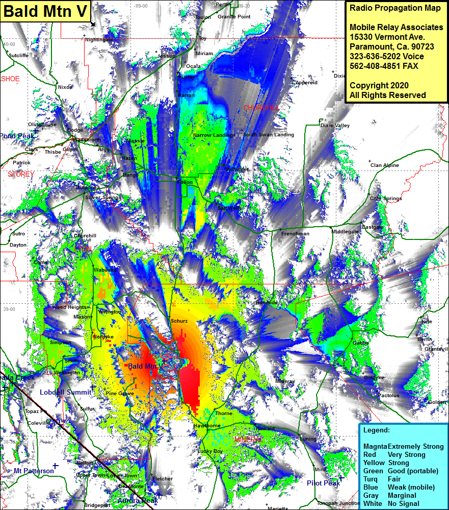 Bald Mtn V Coverage |
| Latitude: | 038 47 04.0N | 38.7844444 |
| Longitude: | 118 50 03.2W | -118.8342222 |
| Feet | Meters | |
| Ground Elevation: | 9202.0 | 2804.8 |
| HAAT: | 3697.0 | 1126.9 |
| City: | Hawthorne | |
| County: | Mineral | |
| State: | Nevada |
This is not an MRA Owned Site. For space rental contact the site owner.
Do you own or manage this site? Click Here
Would you like to add a site to the Google Earth Map?? Click Here
Site Coverage: Coverage of the western portion of Mineral County and the southern portion of Lyon County, Rockland, Pine Grove, Yerington, Weed Heights, Wabuska, Lux, Schurz, Hawthorne, Thorne, Frenchman, Salt Wells, Como, Wellington, Smith, Fletcher, Del Monte, Lower Town, Upper Town, Belfort, Bridgeport, portions of US Hwy 95 from south of Lucky Boy and north to Huxley & Parran