Brock Mtn
| Site Name: | Brock Mtn | 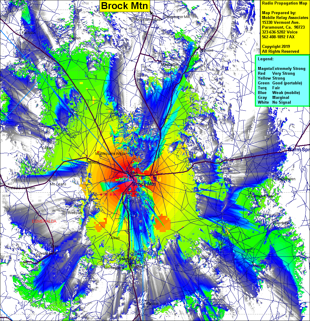 Brock Mtn Coverage |
| Latitude: | 038 03 06.0N | 38.0516667 |
| Longitude: | 117 13 33.7W | -117.2260278 |
| Feet | Meters | |
| Ground Elevation: | 7080.1 | 2158.0 |
| HAAT: | 1435.7 | 437.6 |
| City: | Tonopah | |
| County: | Nye | |
| State: | Nevada |
This is not an MRA Owned Site. For space rental contact the site owner.
Do you own or manage this site? Click Here
Would you like to add a site to the Google Earth Map?? Click Here
Site Coverage: Coverage of Tonopah, Alkali, Goldfield, Montezuma Wells, Millers, McLeans, Golden Arrow, Mellan, Bellmont