Buck Mountain II
| Site Name: | Buck Mountain II | 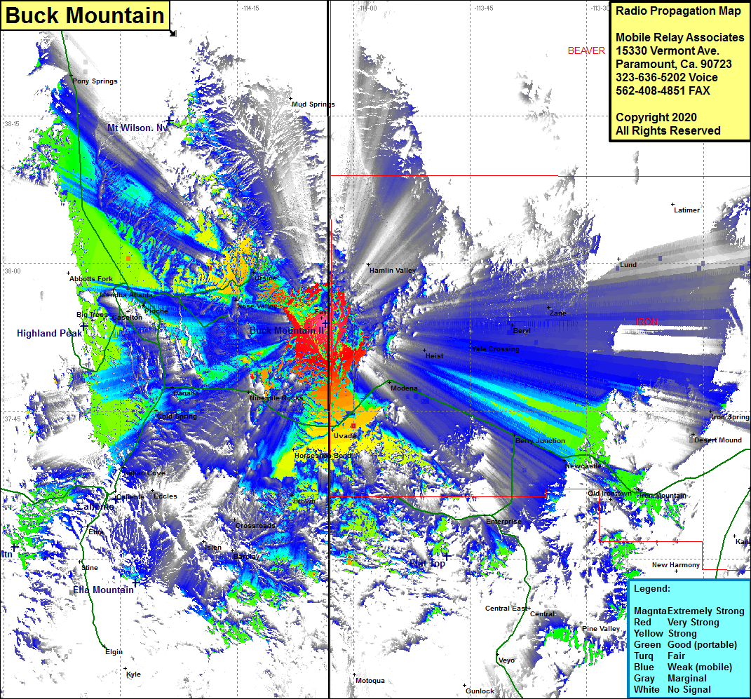 Buck Mountain II Coverage |
| Latitude: | 037 53 54.2N | 37.8983889 |
| Longitude: | 114 03 35.0W | -114.0597222 |
| Feet | Meters | |
| Ground Elevation: | 7389.0 | 2252.2 |
| HAAT: | 680.2 | 207.3 |
| City: | Fay | |
| County: | Lincoln | |
| State: | Nevada |
This is not an MRA Owned Site. For space rental contact the site owner.
Do you own or manage this site? Click Here
Would you like to add a site to the Google Earth Map?? Click Here
Site Coverage: Coverage of the eastern portion of Lincoln County and into Utah, Uvada, Horseshoe Bend, Crestline, Brown, Acoma, Crossroads, Barclay, Islen, Eccles, Indian Cove, Cold Spring, Panaca, Ninemile Rocks, Prince, Atlanta, Pioche, Mendha, Moderna, Heist, Yale Crossing, Beryl, Zane, Berry Junction, Newcastle