Buckskin Mtn
| Site Name: | Buckskin Mtn | 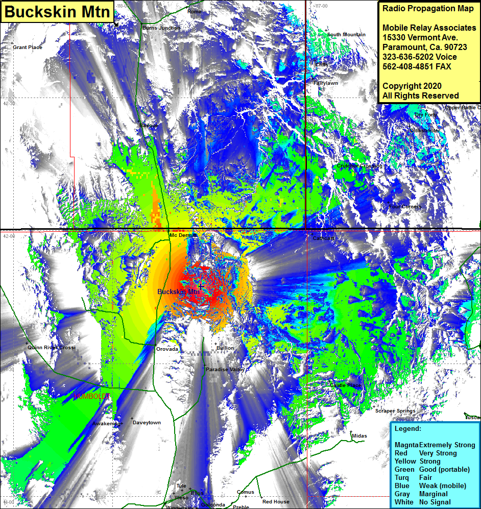 Buckskin Mtn Coverage |
| Latitude: | 041 47 22.0N | 41.7894444 |
| Longitude: | 117 33 09.9W | -117.5527500 |
| Feet | Meters | |
| Ground Elevation: | 8751.0 | 2667.3 |
| HAAT: | 2592.2 | 790.1 |
| City: | Bullion | |
| County: | Humboldt | |
| State: | Nevada |
This is not an MRA Owned Site. For space rental contact the site owner.
Do you own or manage this site? Click Here
Would you like to add a site to the Google Earth Map?? Click Here
Site Coverage: Coverage of the northeastern portion of Humboldt County, the northwest portion of Elko County, the southeast portion of OregonCounty, the southwest portion of Idaho County, US Hwy 95 from north of the junction of Nevada Hwy 140 to Oregon Hwy 78 where US 95 turns east continuing with intermittant coverage for many miles, McDermott, Awakening, Daveytown, Paradise Valley, Castle Place, Cathcart, Four Corners, Fairylawn, Cliffs, Burns Junction, Basque