Burning Man Mtn Site
| Site Name: | Burning Man Mtn Site | 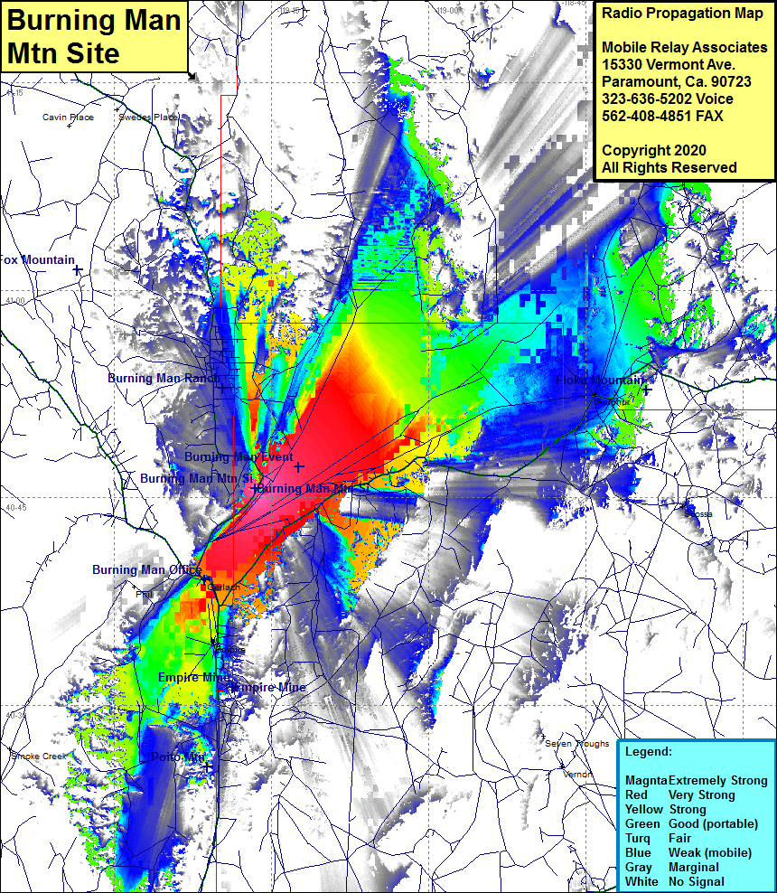 Burning Man Mtn Site Coverage |
| Latitude: | 040 45 39.0N | 40.7608333 |
| Longitude: | 119 16 31.0W | -119.2752778 |
| Feet | Meters | |
| Ground Elevation: | 4354.0 | 1327.1 |
| HAAT: | -18.6 | -5.7 |
| City: | Gerlach | |
| County: | Pershing | |
| State: | Nevada |
This is not an MRA Owned Site. For space rental contact the site owner.
Do you own or manage this site? Click Here
Would you like to add a site to the Google Earth Map?? Click Here
Site Coverage: Coverage of the northwestern portion of Pershing County, the Burning Man event site, Gerlach, Empire, Trego, Sulphur, Scossa, Nevada Highway 447 from Empire through Gerlach, County Road 34 from Gerlach for 26 miles when the road heads into the mountains and heads north past the Burning Man ranch