Burning Man Ranch
| Site Name: | Burning Man Ranch | 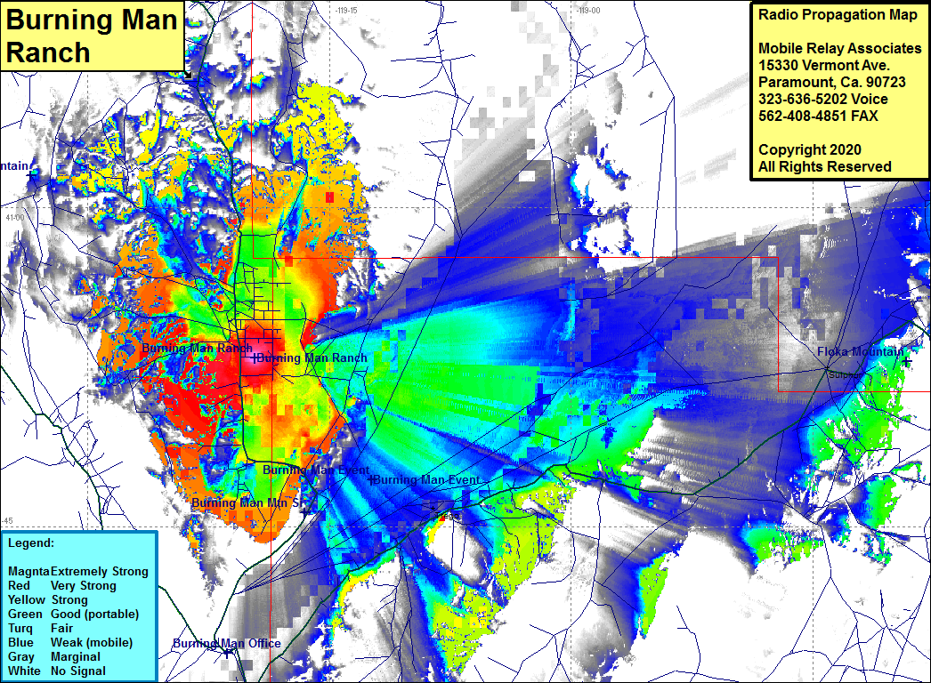 Burning Man Ranch Coverage |
| Latitude: | 040 52 56.0N | 40.8822222 |
| Longitude: | 119 19 37.4W | -119.3270556 |
| Feet | Meters | |
| Ground Elevation: | 4029.0 | 1228.0 |
| HAAT: | -684.9 | -208.8 |
| City: | Gerloch | |
| County: | Washoe | |
| State: | Nevada |
This is not an MRA Owned Site. For space rental contact the site owner.
Do you own or manage this site? Click Here
Would you like to add a site to the Google Earth Map?? Click Here
Site Coverage: Coverage of the Burning Man Ranch and the valley in which it is located, Trego, Sulphur, Highway 48 & Highway 49 (Jungo Road) from Gerlach area northeast about 5 miles past Sulphur