Burning Man Site 5
| Site Name: | Burning Man Site 5 | 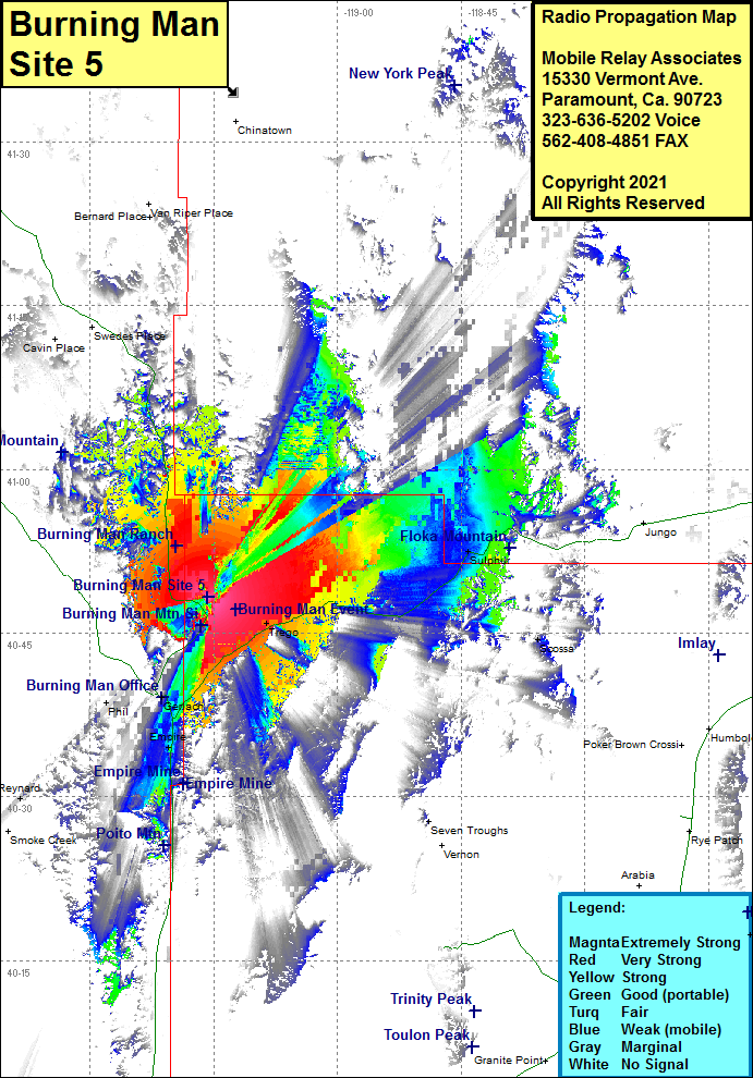 Burning Man Site 5 Coverage |
| Latitude: | 040 48 15.1N | 40.8041944 |
| Longitude: | 119 15 47.2W | -119.2631111 |
| Feet | Meters | |
| Ground Elevation: | 1334.7 | 406.8 |
| HAAT: | 60.4 | 18.4 |
| City: | Empire | |
| County: | Washoe | |
| State: | Nevada |
This is not an MRA Owned Site. For space rental contact the site owner.
Do you own or manage this site? Click Here
Would you like to add a site to the Google Earth Map?? Click Here
Site Coverage: Coverage of Gerlach, Empire, Trego, Sulphur, Seven Troughs, County Road 48 & 49 from Gerlach heading northeast for 20 miles