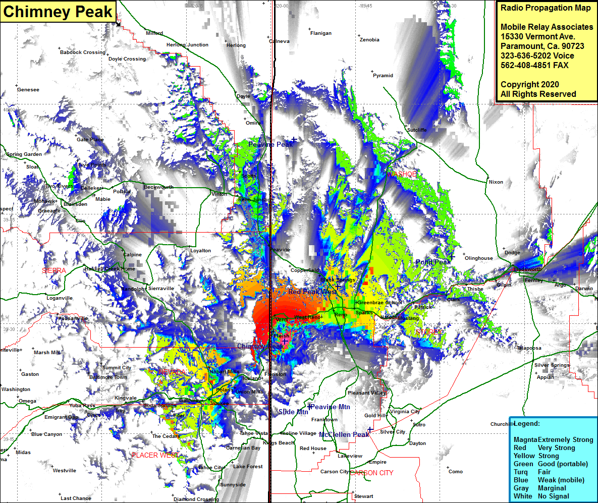
Chimney Peak
| Site Name: | Chimney Peak |  Chimney Peak Coverage |
| Latitude: | 039 27 36.6N | 39.4601667 |
| Longitude: | 119 57 29.8W | -119.9582778 |
| Feet | Meters | |
| Ground Elevation: | 8187.0 | 2495.4 |
| HAAT: | 1836.4 | 559.7 |
| City: | Reno | |
| County: | Washoe | |
| State: | Nevada |
This is not an MRA Owned Site. For space rental contact the site owner.
Do you own or manage this site? Click Here
Would you like to add a site to the Google Earth Map?? Click Here
Site Coverage: Coverage of the Reno area including Interstate 80 from Reno going west past the California border, West Reno, Verdi, Mobul, Sparks, Glendale, Vista, Raleigh Heights, Panther, Black Springs, Martin, Patrick, Clark, Fleish, Hinton, Boca, Hirschdale, Union Mills, Polaris, Truckee, Gateway, Andover, Hobart Mills, Soda Springs
