Chokecherry Mtn
| Site Name: | Chokecherry Mtn | 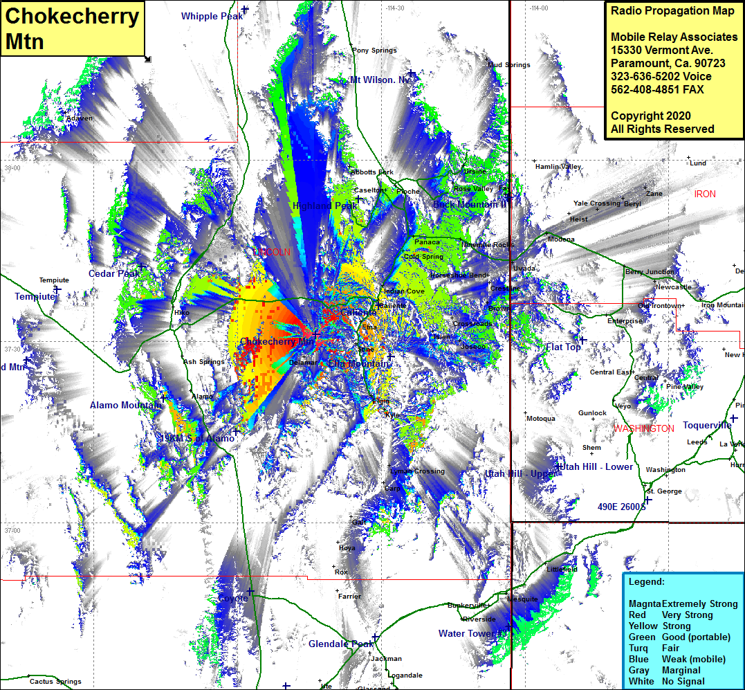 Chokecherry Mtn Coverage |
| Latitude: | 037 31 09.4N | 37.5192778 |
| Longitude: | 114 43 37.3W | -114.7270278 |
| Feet | Meters | |
| Ground Elevation: | 7831.0 | 2386.9 |
| HAAT: | 2183.2 | 665.5 |
| City: | Etan | |
| County: | Lincoln | |
| State: | Nevada |
This is not an MRA Owned Site. For space rental contact the site owner.
Do you own or manage this site? Click Here
Would you like to add a site to the Google Earth Map?? Click Here
Site Coverage: Coverage of Helene, Delamar, Elgin, Kyle, Calente, Indian Cove, Cold Springs, Panaca, Prince, Caselton Heights, Rose Heights, Abbotts Fork, Lyman Crossing, Eccles, Islen, Barclay, Acoma, Brown, Horseshoe Bend, US Highway 93 from Nevada 318 in the west heading northeast towards Panaca and continuing north almost to Nevada Highway 321