Christmas Tree
| Site Name: | Christmas Tree | 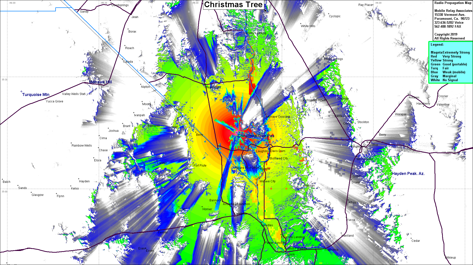 Christmas Tree Coverage |
| Latitude: | 035 15 07.2N | 35.2520000 |
| Longitude: | 114 44 50.3W | -114.7473056 |
| Feet | Meters | |
| Ground Elevation: | 4921.9 | 1500.2 |
| HAAT: | 2339.8 | 713.2 |
| City: | Laughlin | |
| County: | Clark | |
| State: | Nevada |
Would you like to add a site to the Google Earth Map?? Click Here
Site Coverage: Coverage of Laughlin, Bullhead City, Mojave City, Homer, Needles, Parker Jct, Topock, Mohave Crossing, Davis Dam, Riviera, Nelson Landing, Bery, Ft Piute, Searchlight, Juan