Columbia Hill
| Site Name: | Columbia Hill | 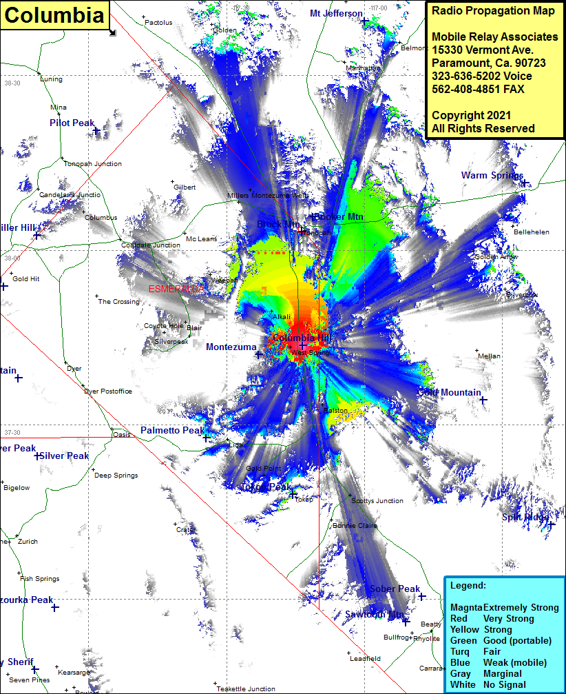 Columbia Hill Coverage |
| Latitude: | 037 43 37.1N | 37.7269722 |
| Longitude: | 117 13 32.2W | -117.2256111 |
| Feet | Meters | |
| Ground Elevation: | 6090.0 | 1856.2 |
| HAAT: | 427.75590551181 | 130.38 |
| City: | Goldfield | |
| County: | Esmeralda | |
| State: | Nevada |
This is not an MRA Owned Site. For space rental contact the site owner.
Do you own or manage this site? Click Here
Would you like to add a site to the Google Earth Map?? Click Here
Site Coverage: Coverage of West Springs, Ralston, Weepah, Alkali, Tonopah, Blair, Coyote Hote, Columbus, Millers, Montezuma Wells, Coaldale Jct, US Highway 95 from Scottys Junction to north of Montezuma Wells