Currant Summit
| Site Name: | Currant Summit | 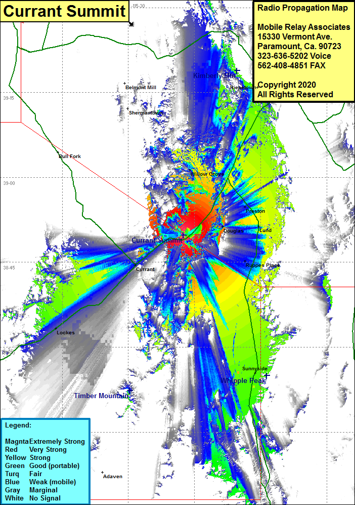 Currant Summit Coverage |
| Latitude: | 038 49 49.1N | 38.8303056 |
| Longitude: | 115 17 32.7W | -115.2924167 |
| Feet | Meters | |
| Ground Elevation: | 7579.0 | 2310.1 |
| HAAT: | 912.0 | 278.0 |
| City: | Currant | |
| County: | Nye | |
| State: | Nevada |
This is not an MRA Owned Site. For space rental contact the site owner.
Do you own or manage this site? Click Here
Would you like to add a site to the Google Earth Map?? Click Here
Site Coverage: Coverage of Willow Grove, Preston, Lund, Ruppes Place, Sunnyside, Currant, Lockes, Nevada Highway 318 from the Nye County Line north to US Highway 6 and continuing northeast most of the way to Ely, US Highway 6 southwest towards Nevada Highway 375.