Denio Summit
| Site Name: | Denio Summit | 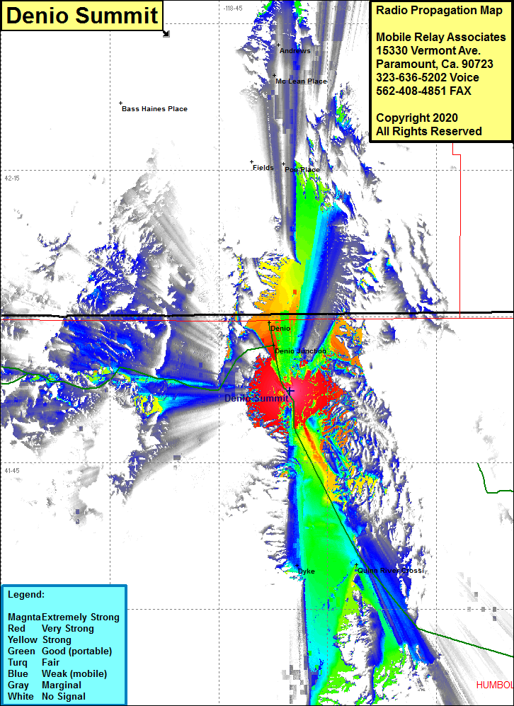 Denio Summit Coverage |
| Latitude: | 041 52 19.7N | 41.8721389 |
| Longitude: | 118 35 10.1W | -118.5861389 |
| Feet | Meters | |
| Ground Elevation: | 5061.0 | 1542.6 |
| HAAT: | 42.2 | 12.9 |
| City: | Denio | |
| County: | Humboldt | |
| State: | Nevada |
This is not an MRA Owned Site. For space rental contact the site owner.
Do you own or manage this site? Click Here
Would you like to add a site to the Google Earth Map?? Click Here
Site Coverage: Coverage of the northcentral area of Humboldt County, Denio, Denio Junction, Quinn River Crossing, Dyke, coverage from Bottle Hill on Nevada Highway 140 going north towards Denio and Nevada Highway 205 north to a few miles south of Fields, Poe Place