Eagle Creek
| Site Name: | Eagle Creek | 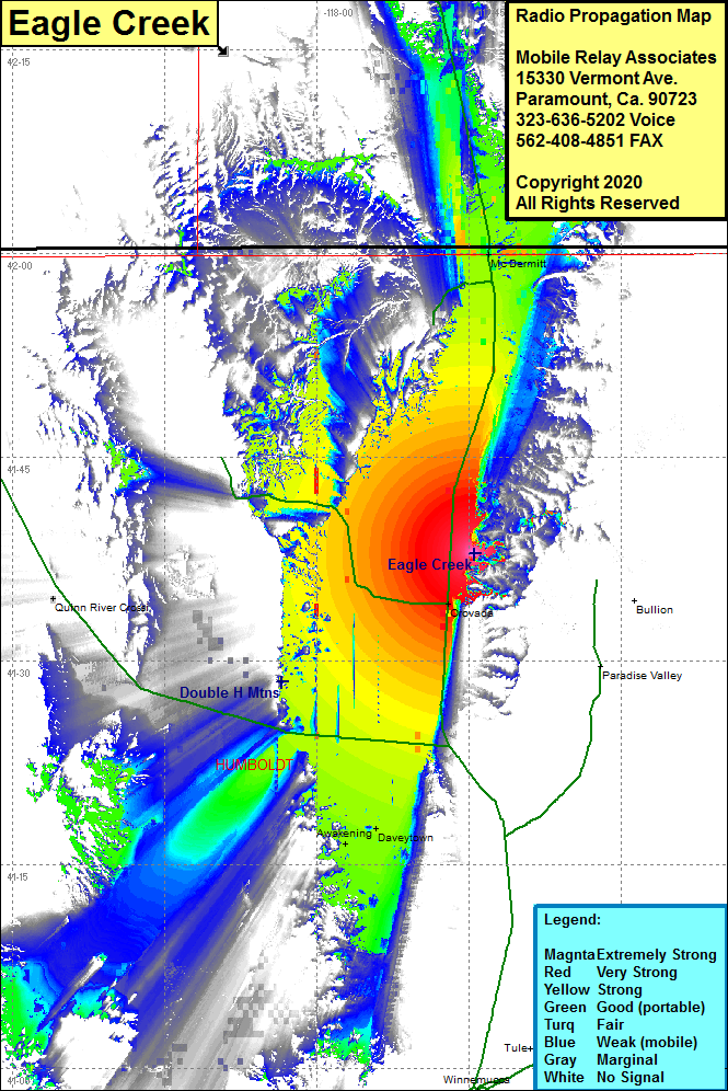 Eagle Creek Coverage |
| Latitude: | 041 37 56.3N | 41.6323056 |
| Longitude: | 117 44 30.4W | -117.7417778 |
| Feet | Meters | |
| Ground Elevation: | 5568.0 | 1697.1 |
| HAAT: | 296.4 | 90.4 |
| City: | Orovada | |
| County: | Humboldt | |
| State: | Nevada |
This is not an MRA Owned Site. For space rental contact the site owner.
Do you own or manage this site? Click Here
Would you like to add a site to the Google Earth Map?? Click Here
Site Coverage: Coverage of the central region of Humboldt County, Awakening, Daveytown, Orovada, McDermitt, US Highway 95 heading north from the Junction of Nevada Highway 140 past McDermitt to a bit south of Basque, Nevada Highway 140 heading west from US Highway 95 until the road turns northwest