Eagle Ridge
| Site Name: | Eagle Ridge | 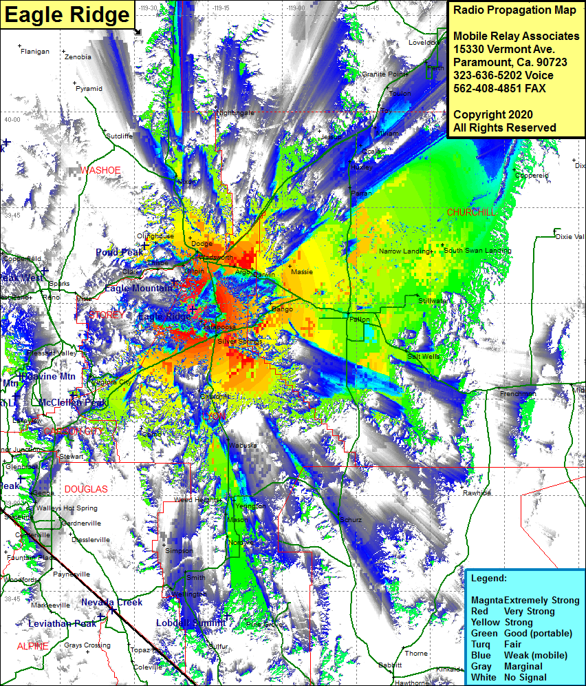 Eagle Ridge Coverage |
| Latitude: | 039 29 04.8N | 39.4846667 |
| Longitude: | 119 18 02.9W | -119.3008056 |
| Feet | Meters | |
| Ground Elevation: | 6893.0 | 2101.0 |
| HAAT: | 1902.8 | 580.0 |
| City: | Silver Springs | |
| County: | Lyon | |
| State: | Nevada |
This is not an MRA Owned Site. For space rental contact the site owner.
Do you own or manage this site? Click Here
Would you like to add a site to the Google Earth Map?? Click Here
Site Coverage: Coverage of the northern portion of Lyon County, Talapoosa, Silver Springs, Appian, Churchill, Sutro, Dayton, Gold Hill, Virginia City, portions of Carson City, Washoe City, Gilpin, Wadsworth, Dodge, Fernley, Argo, Darwin, Massie, Wabuska, Bango, Millens Landing, Narrow Landing, South Swan Landing, Salt Wells, Yerington, Mason, Nordyke, Wellington, Smith, Simpson