East Peak
| Site Name: | East Peak | 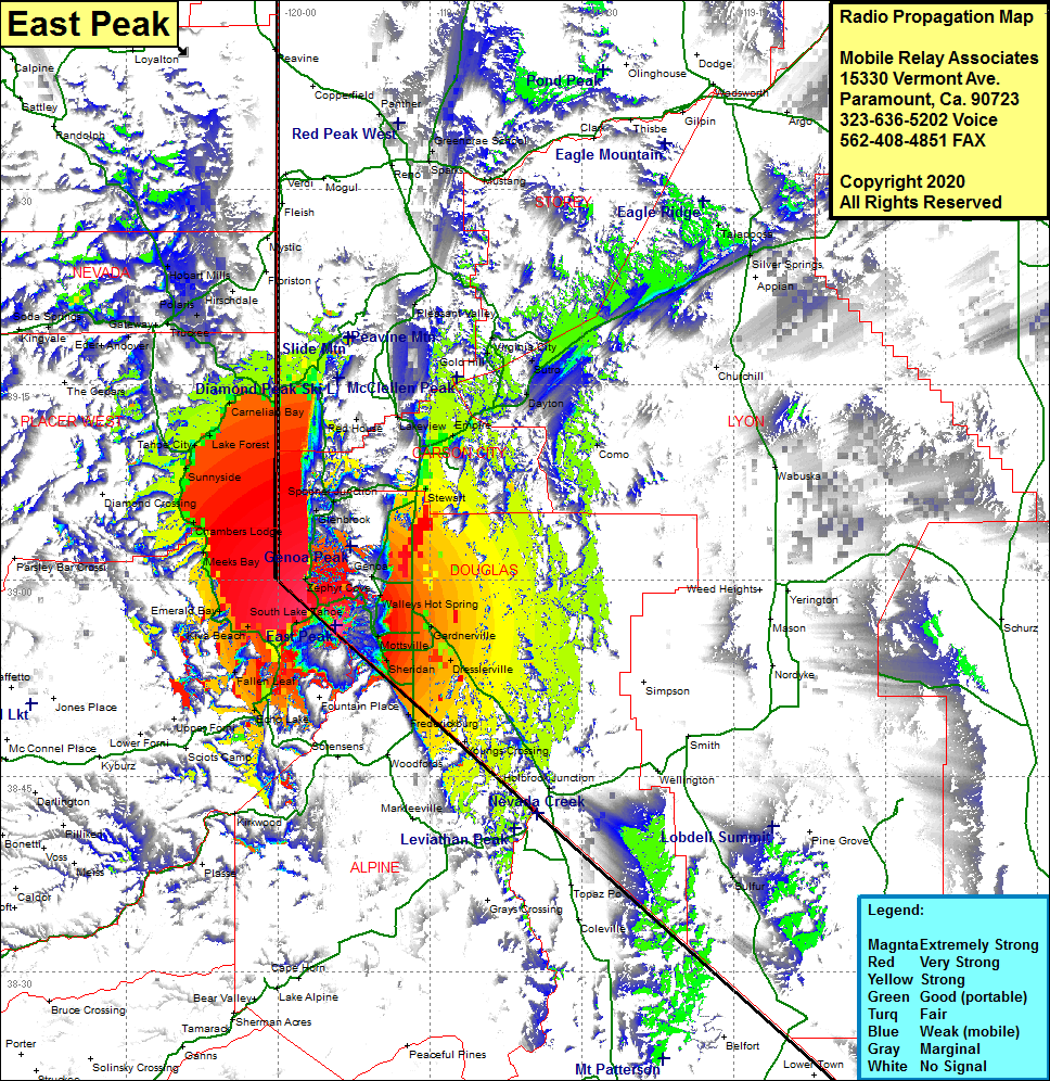 East Peak Coverage |
| Latitude: | 038 56 31.7N | 38.9421389 |
| Longitude: | 119 54 22.8W | -119.9063333 |
| Feet | Meters | |
| Ground Elevation: | 9589.0 | 2922.7 |
| HAAT: | 3212.9 | 979.3 |
| City: | South Lake Tahoe | |
| County: | Douglas | |
| State: | Nevada |
This is not an MRA Owned Site. For space rental contact the site owner.
Do you own or manage this site? Click Here
Would you like to add a site to the Google Earth Map?? Click Here
Site Coverage: Coverage of the Lake Tahoe Basin, north shore, west shore, south shore, South Lake Tahoe, Zephyr Cove,Sheridan, Frederickburg, Young Crossing, Dresslerville, Buckeye, Walleys Hot Springs, Minden, Stewart, Empire, Carson City, Washoe City, Pleasant Valley, Silver City, Silver Springs, Talapoosa