Elko II
| Site Name: | Elko II | 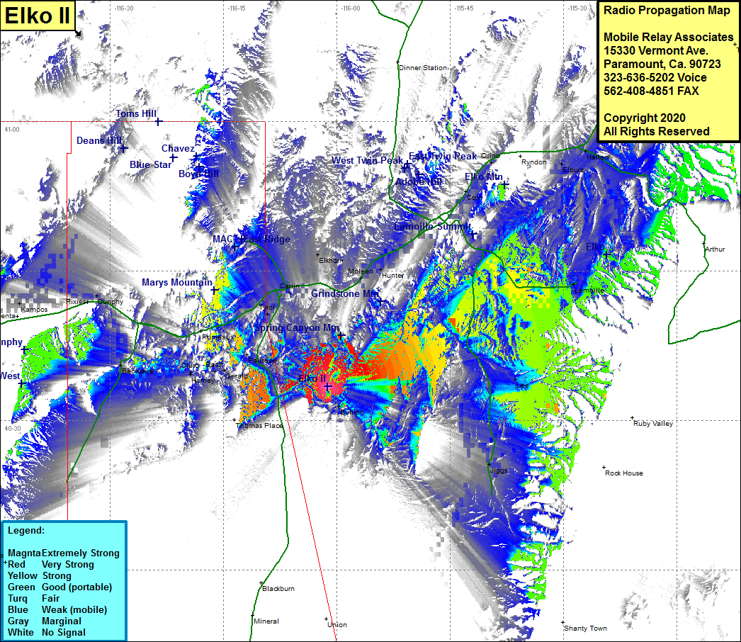 Elko II Coverage |
| Latitude: | 040 33 24.3N | 40.5567500 |
| Longitude: | 116 01 12.3W | -116.0200833 |
| Feet | Meters | |
| Ground Elevation: | 6695.0 | 2040.6 |
| HAAT: | 627.6 | 191.3 |
| City: | Carlin | |
| County: | Elko | |
| State: | Nevada |
This is not an MRA Owned Site. For space rental contact the site owner.
Do you own or manage this site? Click Here
Would you like to add a site to the Google Earth Map?? Click Here
Site Coverage: Coverage of the southeastern portion of Elko County, Carlin, Elkhorn, Hunter, Elko, Coin Lamoille, Lee, Jiggs, Halleck, Elburz, Deeth, Primeaux, Dunphy, Rixies, Kampos, Argenta, Beowave, Bannock, Galena, Copper Basin