Ellen Dee Mtn
| Site Name: | Ellen Dee Mtn | 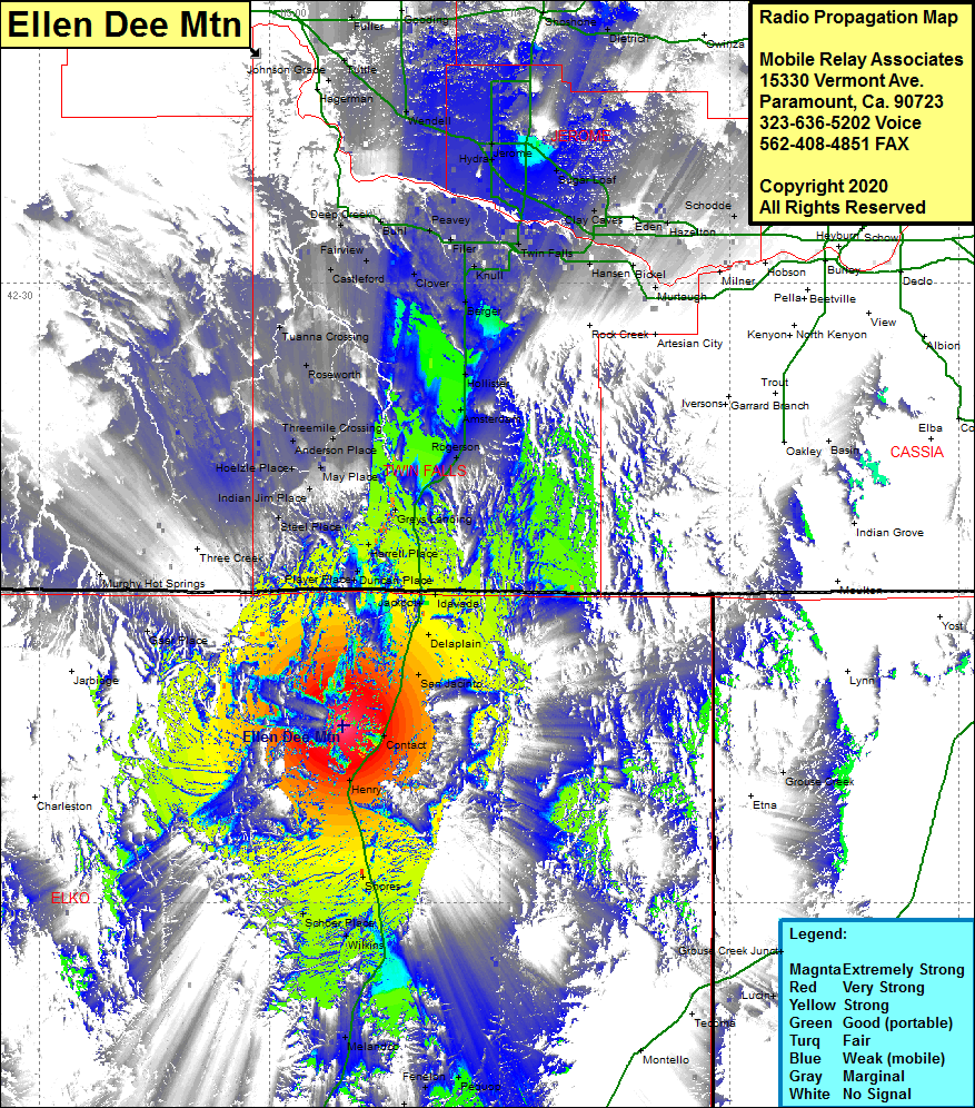 Ellen Dee Mtn Coverage |
| Latitude: | 041 47 06.7N | 41.7851944 |
| Longitude: | 114 50 25.1W | -114.8403056 |
| Feet | Meters | |
| Ground Elevation: | 8641.0 | 2633.8 |
| HAAT: | 2456.1 | 748.6 |
| City: | Henry | |
| County: | Elko | |
| State: | Nevada |
This is not an MRA Owned Site. For space rental contact the site owner.
Do you own or manage this site? Click Here
Would you like to add a site to the Google Earth Map?? Click Here
Site Coverage: Coverage of the northeast corner of Elko County, US Highway 93 from the intersection of Interstate 80 in the south to north of the Nevada border to Filer at US Highway 30, Jerome, Wendell, Gooding, Shoshone, Sugar Loaf, Twin Falls, Knull, Berger, Hollister, Amsterdam, Rogerson, Greys Landing, Harrell Place, Duncan Place, Jackpot, Idavada, Delaplain, San Jacinto, Henry, Shores, Schoer Place, Wilkins, Melandco, Fenelon, Holborn, Deeth, Gaar Place, Indian Jim Place, Hoelzle Place, Anderson Place, Threemile Crossing, Roseworth, Tuanna Crossing, Castleford, Deep Creek, Buhl, Peavey