Fernley
| Site Name: | Fernley | 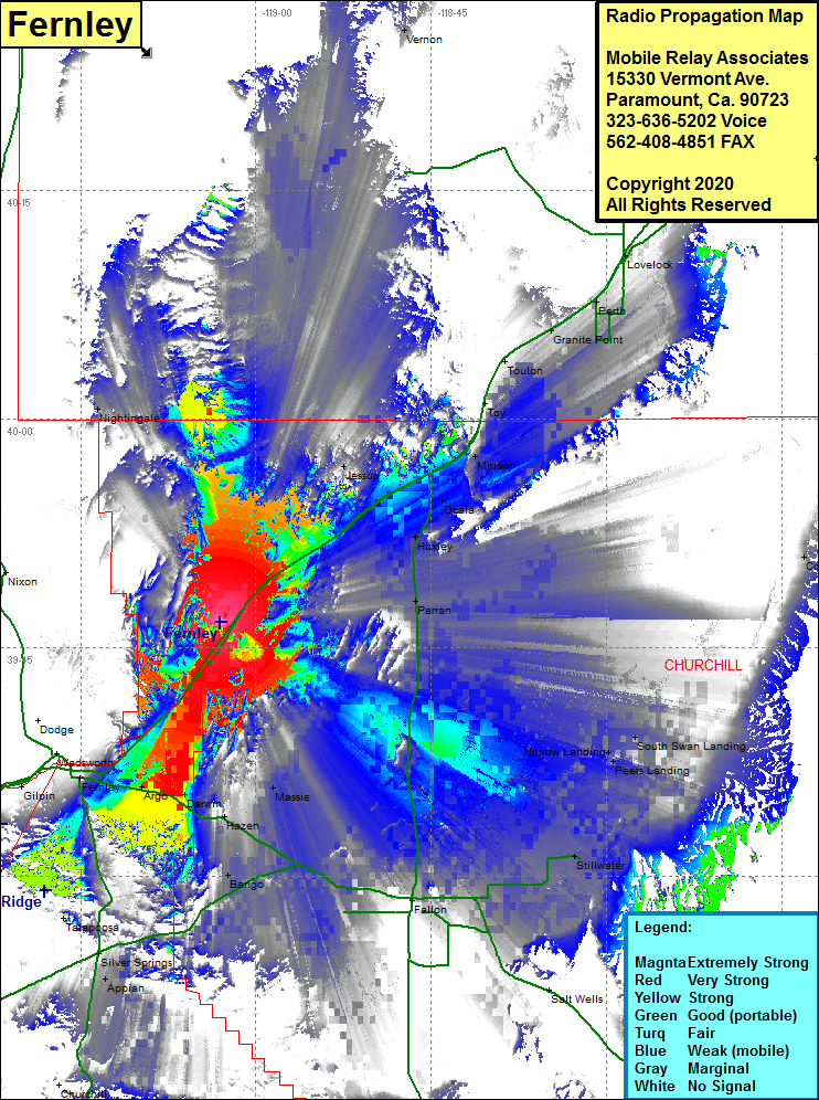 Fernley Coverage |
| Latitude: | 039 46 39.3N | 39.7775833 |
| Longitude: | 119 03 03.4W | -119.0509444 |
| Feet | Meters | |
| Ground Elevation: | 4424.0 | 1348.4 |
| HAAT: | -158.3 | -48.2 |
| City: | Parran | |
| County: | Churchell | |
| State: | Nevada |
This is not an MRA Owned Site. For space rental contact the site owner.
Do you own or manage this site? Click Here
Would you like to add a site to the Google Earth Map?? Click Here
Site Coverage: Coverage of the western portion of Churchill County, Interstate 80 from Fernley in the southwest to Woolsey in the north, Fernley, Argo, Darwin, Hazen, Bango, Stillwater, Millens Landing, Narrow Landing, South Swan Landing, Parran, Huxley, Ocala, Miriam, Jessup, Toy, Toulon, Granite Point, Peeth, Lovelock, Nightingale