Goshute Mtn
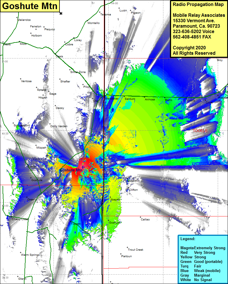
| Site Name: | Goshute Mtn |  Goshute Mtn Coverage |
| Latitude: | 040 14 41.3N | 40.2448056 |
| Longitude: | 114 14 04.9W | -114.2346944 |
| Feet | Meters | |
| Ground Elevation: | 7060.0 | 2151.9 |
| HAAT: | 1128.9 | 344.1 |
| City: | Goshute | |
| County: | Elko | |
| State: | Nevada |
This is not an MRA Owned Site. For space rental contact the site owner.
Do you own or manage this site? Click Here
Would you like to add a site to the Google Earth Map?? Click Here
Site Coverage: Coverage of the southeastern portion of Elko County plus southwestern Utah including Goshute, Tippett, Goshute Nevada, Goshute Utah, Ibapah, Clifton, Gold Hill, Oka, Wendover, Silsbee, Arinosa, Barro, Knolls, Clive, Aragonite, Low, Cherry Creek, Currie, Lincoln Highway 93A from the junction of Great Basin Highway 93 northeast to Wendover, and Great Basin Highway 93 to just south of Sprucemont
