Imlay
| Site Name: | Imlay | 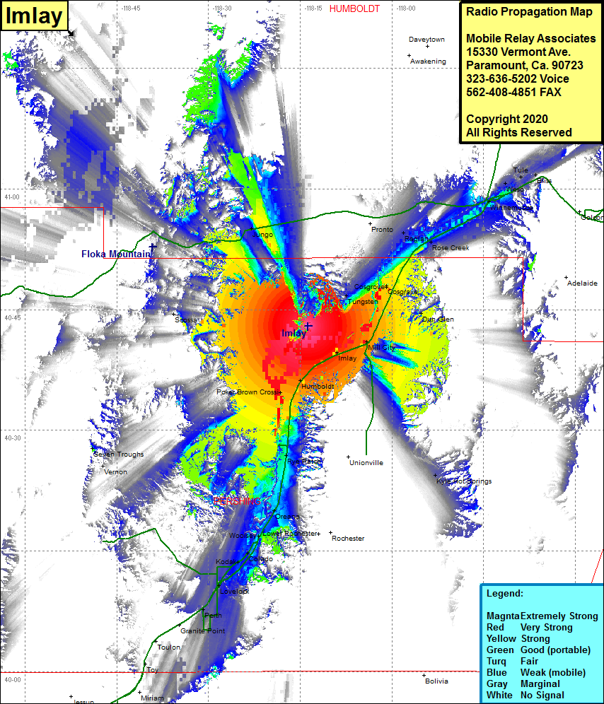 Imlay Coverage |
| Latitude: | 040 42 57.5N | 40.7159722 |
| Longitude: | 118 13 47.0W | -118.2297222 |
| Feet | Meters | |
| Ground Elevation: | 5141.0 | 1567.0 |
| HAAT: | 677.1 | 206.4 |
| City: | Imlay | |
| County: | Pershing | |
| State: | Nevada |
This is not an MRA Owned Site. For space rental contact the site owner.
Do you own or manage this site? Click Here
Would you like to add a site to the Google Earth Map?? Click Here
Site Coverage: Coverage of the northcentral portion of Pershing County, Humboldt, Imlay, Mill City, Dun Glen, Cosgrove, Rose Creek, Raglan, Pronto, Tungsten, Jungo, Scossa, Poker Brown Crossing, Rye Patch, Colado, Kodak, Lovelock, Perth, Winnemucca, Weso, Tule, Bliss, Kyle Hot Springs and Interstate 80 from Lovelock to Winnemucca