Kimberly Mtn
| Site Name: | Kimberly Mtn | 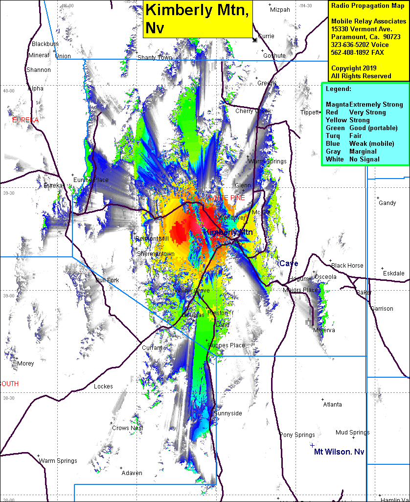 Kimberly Mtn Coverage |
| Latitude: | 039 18 53.8N | 39.3149444 |
| Longitude: | 115 05 21.1W | -115.0891944 |
| Feet | Meters | |
| Ground Elevation: | 9235.6 | 2815.0 |
| HAAT: | 2302.0 | 701.7 |
| City: | Kimberly | |
| County: | White Pine | |
| State: | Nevada |
This is not an MRA Owned Site. For space rental contact the site owner.
Do you own or manage this site? Click Here
Would you like to add a site to the Google Earth Map?? Click Here
Site Coverage: Coverage of Kimberly, Riepetown, Mosier, Preston, Ruapes Place, Belmont Mill, Shermantown, Glenn, Warm Springs, McGill, Wendover