Kinkaid Mountain
| Site Name: | Kinkaid Mountain | 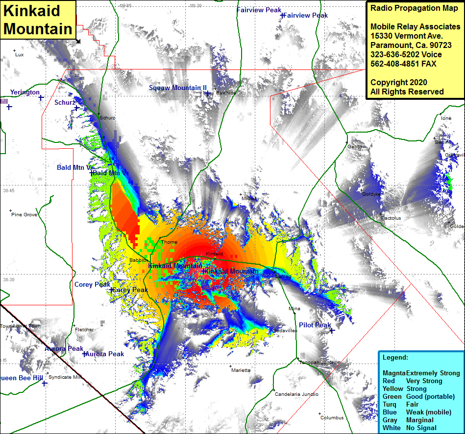 Kinkaid Mountain Coverage |
| Latitude: | 038 30 32.8N | 38.5091111 |
| Longitude: | 118 26 06.0W | -118.4350000 |
| Feet | Meters | |
| Ground Elevation: | 6467.0 | 1971.1 |
| HAAT: | 1257.1 | 383.2 |
| City: | Kinkaid | |
| County: | Mineral | |
| State: | Nevada |
This is not an MRA Owned Site. For space rental contact the site owner.
Do you own or manage this site? Click Here
Would you like to add a site to the Google Earth Map?? Click Here
Site Coverage: Coverage of the central portion of Mineral County, Nevada Highway 359 through Hawthorne and north past Throne, US Highway 95 from Hawthorne to Schurz and from Hawthorne to Luning, Hawthorne, Kinkaid, Luning, Babbitt, Thorne, Schurz