Lantern
| Site Name: | Lantern | 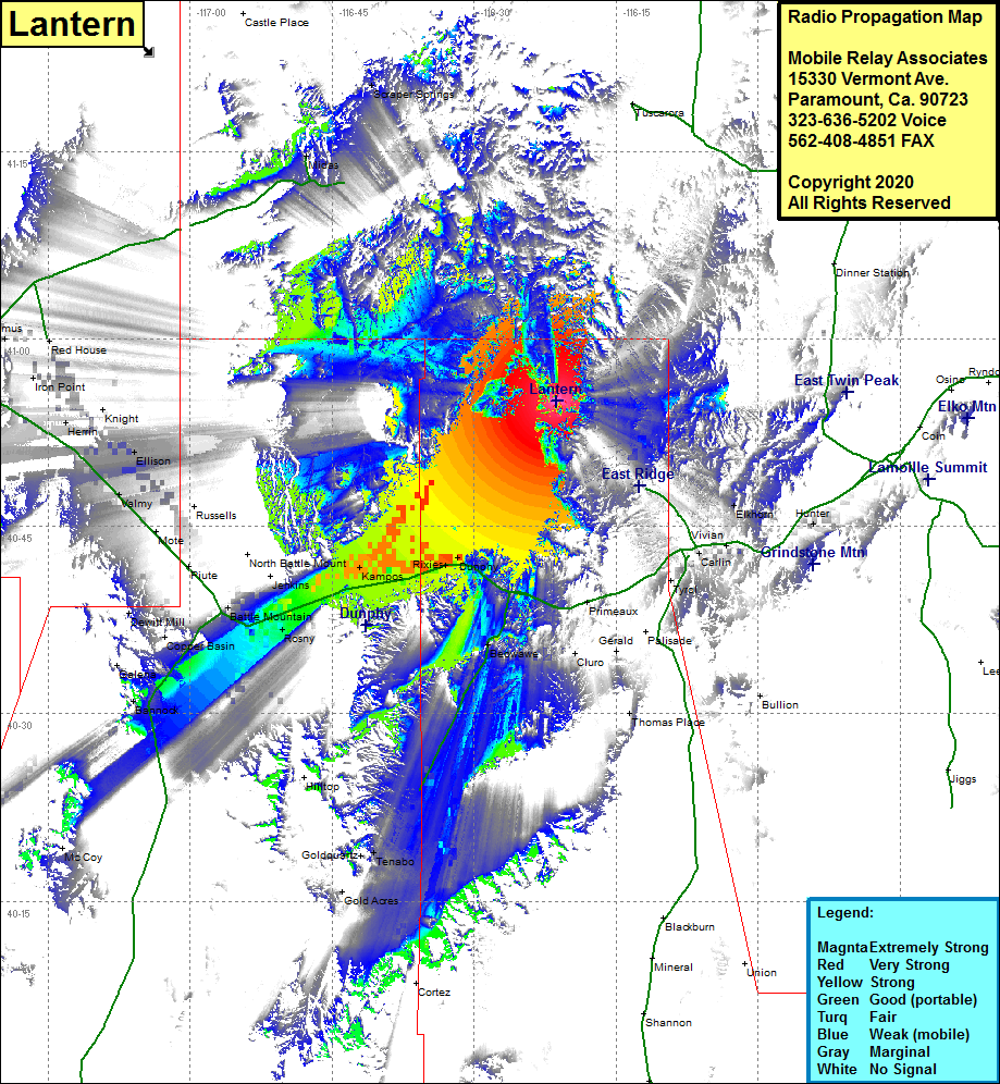 Lantern Coverage |
| Latitude: | 040 55 03.3N | 40.9175833 |
| Longitude: | 116 21 20.5W | -116.3556944 |
| Feet | Meters | |
| Ground Elevation: | 6114.0 | 1863.5 |
| HAAT: | 668.2 | 203.7 |
| City: | Dunphy | |
| County: | Eureka | |
| State: | Nevada |
This is not an MRA Owned Site. For space rental contact the site owner.
Do you own or manage this site? Click Here
Would you like to add a site to the Google Earth Map?? Click Here
Site Coverage: Coverage of the northern portion of Eureka County and Lander County, Rixies, Dunphy, Mosel, Argenta, Kampos, Battle Mountain, Harney, Cluro, Tenabo, Carlin, Moleen, Hunter, Ellison, Iron Point, Comus, Herrin