Lovelock I
| Site Name: | Lovelock I | 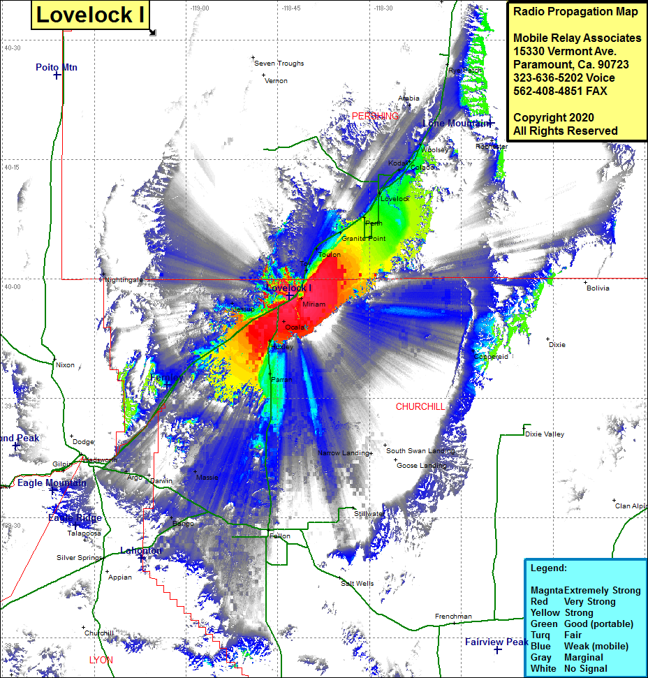 Lovelock I Coverage |
| Latitude: | 039 57 55.7N | 39.9654722 |
| Longitude: | 118 43 03.6W | -118.7176667 |
| Feet | Meters | |
| Ground Elevation: | 4254.0 | 1296.6 |
| HAAT: | 14.3 | 4.4 |
| City: | Miriam | |
| County: | Churchill | |
| State: | Nevada |
This is not an MRA Owned Site. For space rental contact the site owner.
Do you own or manage this site? Click Here
Would you like to add a site to the Google Earth Map?? Click Here
Site Coverage: Coverage of the west central portion of Churchill County, Ocela, Miriam, Toy, Toulon, Granite, Perth, Lovelock, Kodak, Calado, Woolsey, Oreana, Arabia, Rye Patch, Parran, Massie, Plazen, Fallon, Bango, Hazen, Algo