Lovelock II
| Site Name: | Lovelock II |  Lovelock II Coverage |
| Latitude: | 040 16 09.8N | 40.2693889 |
| Longitude: | 118 16 00.6W | -118.2668333 |
| Feet | Meters | |
| Ground Elevation: | 5920.0 | 1804.4 |
| HAAT: | 930.9 | 283.8 |
| City: | Oreans | |
| County: | Pershing | |
| State: | Nevada |
This is not an MRA Owned Site. For space rental contact the site owner.
Do you own or manage this site? Click Here
Would you like to add a site to the Google Earth Map?? Click Here
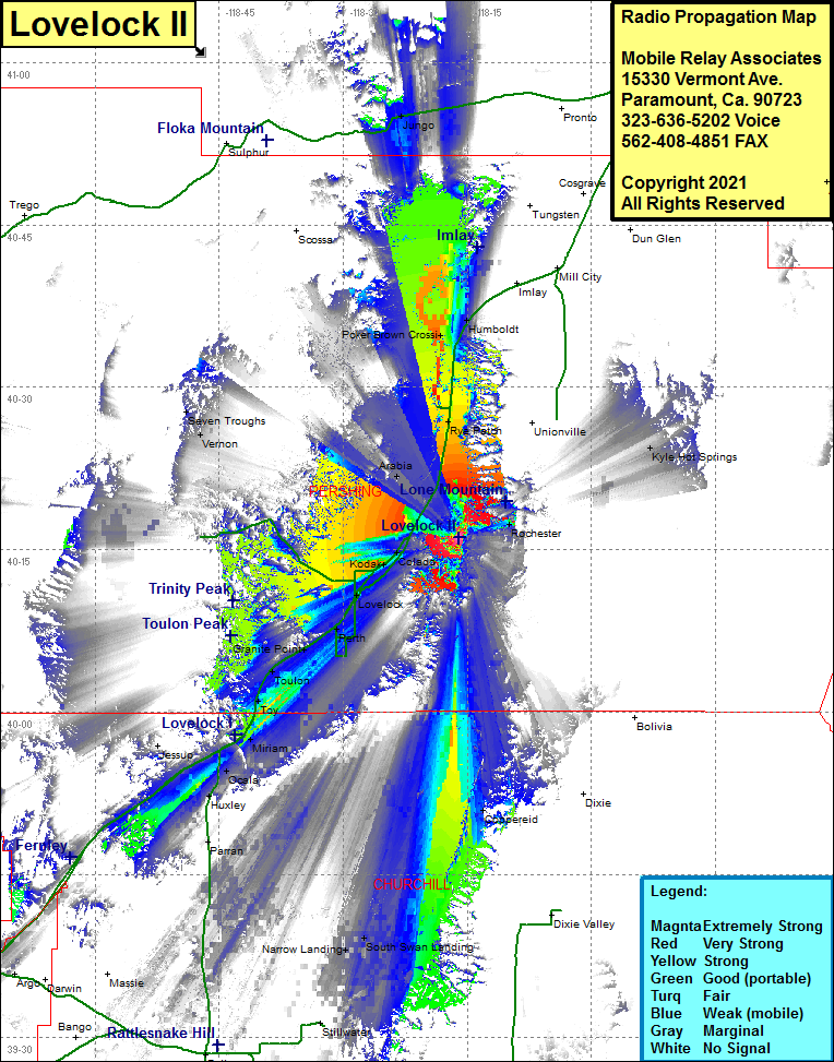
Site Coverage: Coverage of the south central portion of Pershing County and the north central portion of Churchill County, Toy, Toulon, Granite Point, Perth, Lovelock, Kodak, Colado, Rochester, Arabia, Rye Patch, Unionville, Kyle Hot Springs, Vernon, Seven Troughs, Poker Brown Crossing, Humboldt, Miriam, Ocala, Huxley, Coppereid, Interstate Highway 80 from Huxley in the south to Humboldt in the north
