Lower Potosi
| Site Name: | Lower Potosi | 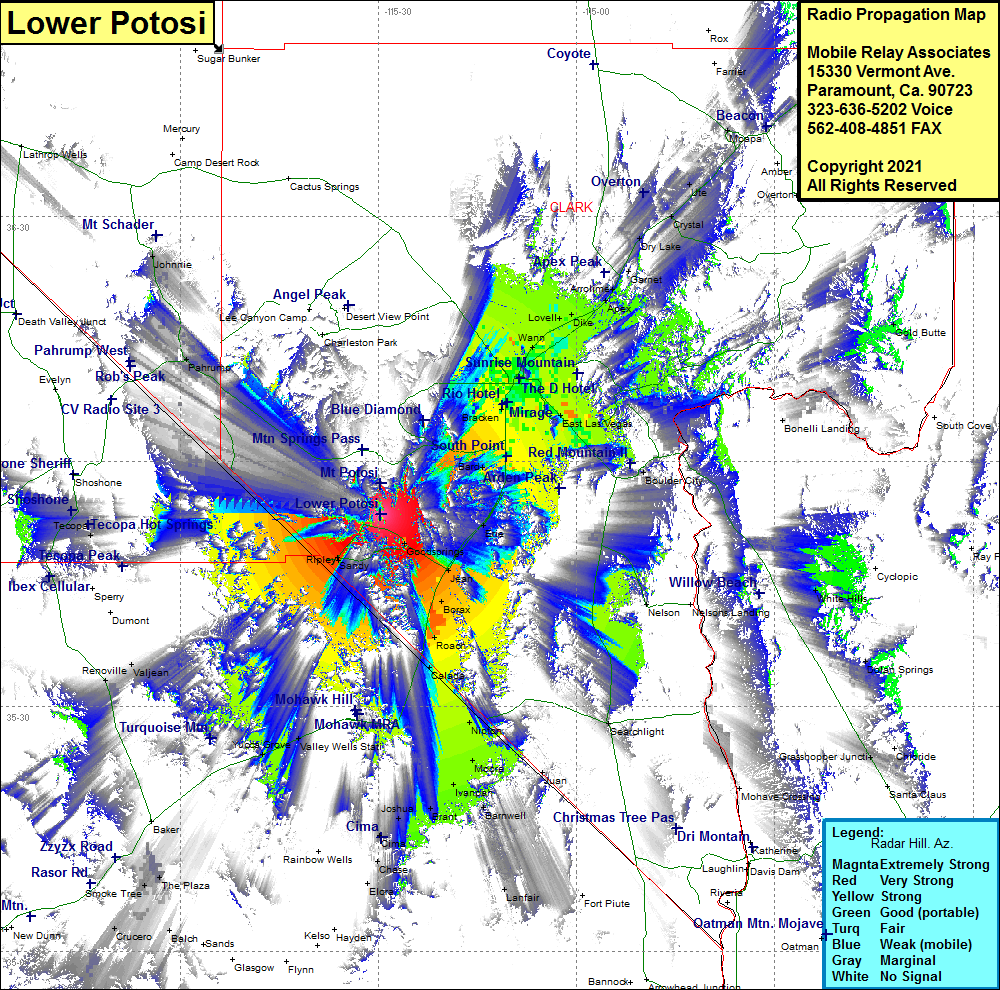 Lower Potosi Coverage |
| Latitude: | 035 53 34.2N | 35.8928333 |
| Longitude: | 115 29 42.6W | -115.4951667 |
| Feet | Meters | |
| Ground Elevation: | 6225.0 | 1897.4 |
| HAAT: | 1846.5 | 562.8 |
| City: | Goodsprings | |
| County: | Clark | |
| State: | Nevada |
This is not an MRA Owned Site. For space rental contact the site owner.
Do you own or manage this site? Click Here
Would you like to add a site to the Google Earth Map?? Click Here
Site Coverage: Coverage of Calada, Roach, Borax, Jean, Goodsprings, Sandy, Yucca Grove, Valley Wells Station, Joshua, Brant, Ivanpah, Nipton, Moore, Vanderbilt, Barnwell, Henderson, Boulder Junction, Paradise, East Las Vegas, Bracken, Winchester, Las Vegas, North Las Vegas, Wann, Valley, Novell, Dike, Apex, Arrolime, Crystal, Ute, Dry Lake, Pahrump, Johnnie, Sandy, Valjean, Yucca Grove, Valley Wells Station, Wheaton Springs, Chase, Lanfair, Hart, Barnwell