Luhr Hill
| Site Name: | Luhr Hill | 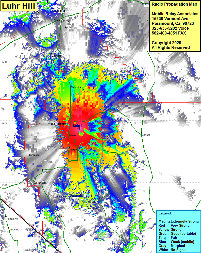 Luhr Hill Coverage |
| Latitude: | 038 58 09.0N | 38.9691667 |
| Longitude: | 119 07 54.2W | -119.1317222 |
| Feet | Meters | |
| Ground Elevation: | 4790.0 | 1460.0 |
| HAAT: | 130.4 | 39.8 |
| City: | Yerington | |
| County: | Lyon | |
| State: | Nevada |
This is not an MRA Owned Site. For space rental contact the site owner.
Do you own or manage this site? Click Here
Would you like to add a site to the Google Earth Map?? Click Here
Site Coverage: Coverage of the central portion of Lyon County, Yerington, Weed Heights, Mason, Nordyke, Smith, Wabuska, Lux, Simpson, Como, Churchill, Appian, Fallon, Rockland, Pine Grove, Wellington