Marble Bluff
| Site Name: | Marble Bluff | 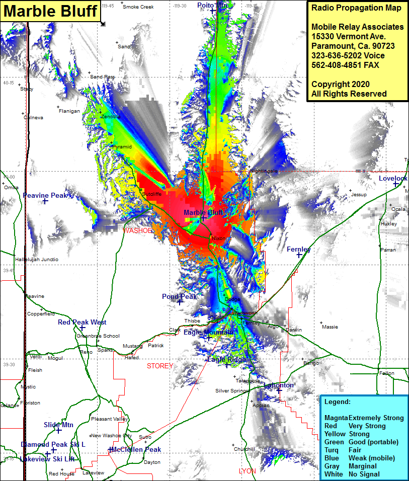 Marble Bluff Coverage |
| Latitude: | 039 52 28.3N | 39.8745278 |
| Longitude: | 119 22 56.5W | -119.3823611 |
| Feet | Meters | |
| Ground Elevation: | 4538.0 | 1383.2 |
| HAAT: | 226.1 | 68.9 |
| City: | Nixon | |
| County: | Washoe | |
| State: | Nevada |
This is not an MRA Owned Site. For space rental contact the site owner.
Do you own or manage this site? Click Here
Would you like to add a site to the Google Earth Map?? Click Here
Site Coverage: Coverage of the southcentral portion of Washoe County, Nixon, Sutcliffe, Pyramid, Zenobia, Dodge, Wadsworth, Fernlay, Argo, Darwin, Gilpin, Nevada Highway 447 from south of Interstate 80 to 5 miles south of Empire, Nevada Highway 446 from Nevada Highway 447 to Nevada Highway 445 and continuing north to Zenobia