Marys Mountain
| Site Name: | Marys Mountain | 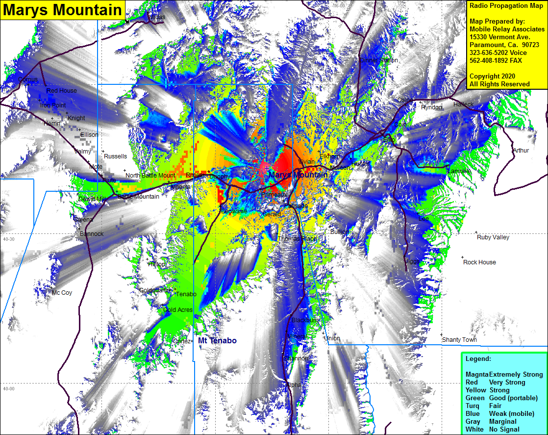 Marys Mountain Coverage |
| Latitude: | 040 43 07.0N | 40.7186111 |
| Longitude: | 116 16 15.0W | -116.2708333 |
| Feet | Meters | |
| Ground Elevation: | 7561.0 | 2304.6 |
| HAAT: | 2052.7 | 625.7 |
| City: | Carlin | |
| County: | Eureka | |
| State: | Nevada |
This is not an MRA Owned Site. For space rental contact the site owner.
Do you own or manage this site? Click Here
Would you like to add a site to the Google Earth Map?? Click Here
Site Coverage: Coverage of the northern portion of Eureka County, Palisade, Barth, Gerald, Harney, Cluro, Primeaux, Dunphy, Beowave, Argena, Rosny, Piute, Valmy, Herrin, Knight, Iron Point, McCoy, Gold Acres, Tenabo, Goldquartz, Alpha, Shannon, Moneral, Blackburn, Thomas Place, Bullion, Elkhorn, Hunter, Elko, Jiggs, Lee, Lamoille, Coin, Osino, Ryndon, Halleck, Deeth, Dinner Station, Tuscarora, Scraper Springs