McCoy Cove
| Site Name: | McCoy Cove | 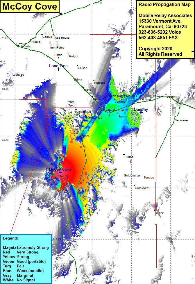 McCoy Cove Coverage |
| Latitude: | 040 19 36.9N | 40.3269167 |
| Longitude: | 117 12 33.6W | -117.2093333 |
| Feet | Meters | |
| Ground Elevation: | 5593.0 | 1704.7 |
| HAAT: | 487.5 | 148.6 |
| City: | McCoy | |
| County: | Lander | |
| State: | Nevada |
This is not an MRA Owned Site. For space rental contact the site owner.
Do you own or manage this site? Click Here
Would you like to add a site to the Google Earth Map?? Click Here
Site Coverage: Coverage of the northwest portion of Lander County, Bannock, Galena, Dewitt Mill, McCoy, Rosny, Argenta, Cortez, Nevada Highway 305 from 25 miles north of Austin to Interstate 80, Interstate 80 from 3 miles west of Battle Mountain to 12 miles east of Battle Mountain