Merritt Mtn
| Site Name: | Merritt Mtn |  Merritt Mtn Coverage |
| Latitude: | 041 51 44.2N | 41.8622778 |
| Longitude: | 115 50 23.2W | -115.8397778 |
| Feet | Meters | |
| Ground Elevation: | 8754.0 | 2668.2 |
| HAAT: | 2182.3 | 665.2 |
| City: | Mountain City | |
| County: | Elko | |
| State: | Nevada |
This is not an MRA Owned Site. For space rental contact the site owner.
Do you own or manage this site? Click Here
Would you like to add a site to the Google Earth Map?? Click Here
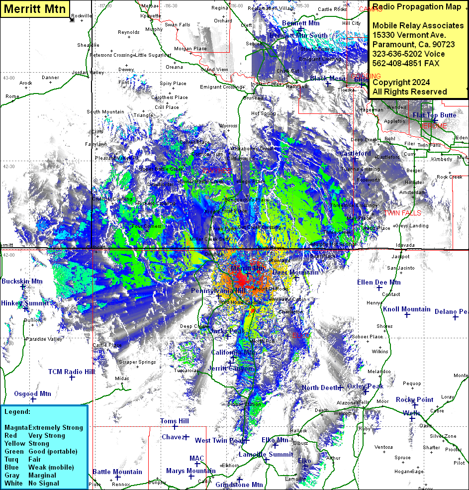
Site Coverage: Coverage of James Place, Cat Creek Crossing, Three Forks, Black Rock Crossing, Rock House, Rowland, Jarbridge, Gaar Place, Murphy Hot Springs, Three Creek, Steel Place, Indian Jim Place, Hoelzle Place, May Place, Anderson Place, Threemile Crossing, Roseworth, Tuanna Crossing, Castleford, Fairview, Clover, Cedar, Deep Creek, Buhl, Barrymore, Jerome, Appleton, Wendell, Sugar Loaf, Clay Caves, Hunt, Tuttle, Hageman, Bliss, Ticeska, Hummett, Chair Cut, Reverse, Mountain Home, Emigrant Crossing, Stout Crossing, Point of Rocks, Charleston, Williams Cabin, North Fork, Edburz, Deeth, Alazon, Mountain City, Patsville, Wild Horse Crossing, North Fork, Tuscarora, Deep Creek, Dinner Station, Owyhee, Miller Creek Settlelement, Riddle, Three Forks, Dew Drop, China Hat, Bull Creek Crossing, Dans Place, Bengoechea Place, Grasmere, Frost Place, DIckens Place, Sego Place, Cottonwood, Buncel Place, Comical Turn, Collier Place, Harvey Place, Upper Battle Creek, Dry Forty, Blue Creek Crossing, Dickshooter, Lower Battle Creek, Four Corners, Crutcher Crossing, Richard Crossing
